Bhuntar
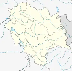
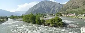
Bhuntar is a town and a nagar panchayat in Kullu district in the state of Himachal Pradesh, India. It is just 11 km from Kullu town, and lies along National Highway 3. The Kullu Airport is located in Bhuntar. Bhuntar is located on the right bank of the Beas River. Right opposite to Bhuntar, near the left bank of the Beas River, there is the confluence of the Parvati River with the River Beas. The Parvati Valley begins at this confluence and runs eastward, through a steep-sided valley towards Kasol and Manikaran.
Bhuntar | |
|---|---|
Town | |
 Bhuntar town | |
 Bhuntar Location in Himachal Pradesh, India  Bhuntar Bhuntar (India) | |
| Coordinates: 31.86°N 77.15°E | |
| Country | |
| State | Himachal Pradesh |
| District | Kullu |
| Population (2011) | |
| • Total | 4,475 |
| Languages | |
| • Official | Hindi |
| Time zone | UTC+5:30 (IST) |
| Vehicle registration | HP |
Climate
| Climate data for Bhuntar (Kullu–Manali Airport) 1981–2010, extremes 1960–2011) | |||||||||||||
|---|---|---|---|---|---|---|---|---|---|---|---|---|---|
| Month | Jan | Feb | Mar | Apr | May | Jun | Jul | Aug | Sep | Oct | Nov | Dec | Year |
| Record high °C (°F) | 25.4 (77.7) |
27.1 (80.8) |
32.3 (90.1) |
37.3 (99.1) |
40.0 (104.0) |
39.4 (102.9) |
37.4 (99.3) |
37.8 (100.0) |
35.2 (95.4) |
33.2 (91.8) |
29.4 (84.9) |
27.0 (80.6) |
40.0 (104.0) |
| Average high °C (°F) | 16.0 (60.8) |
18.0 (64.4) |
22.1 (71.8) |
27.2 (81.0) |
31.0 (87.8) |
33.1 (91.6) |
31.7 (89.1) |
31.0 (87.8) |
30.1 (86.2) |
27.8 (82.0) |
23.0 (73.4) |
17.8 (64.0) |
25.7 (78.3) |
| Average low °C (°F) | 1.6 (34.9) |
3.7 (38.7) |
6.7 (44.1) |
9.7 (49.5) |
12.9 (55.2) |
16.8 (62.2) |
19.9 (67.8) |
19.9 (67.8) |
16.6 (61.9) |
9.8 (49.6) |
4.6 (40.3) |
1.7 (35.1) |
10.3 (50.5) |
| Record low °C (°F) | −4.7 (23.5) |
−4.5 (23.9) |
0.2 (32.4) |
3.5 (38.3) |
4.6 (40.3) |
6.1 (43.0) |
11.1 (52.0) |
10.9 (51.6) |
7.8 (46.0) |
3.5 (38.3) |
−1.5 (29.3) |
−5.2 (22.6) |
−5.2 (22.6) |
| Average rainfall mm (inches) | 77.0 (3.03) |
110.7 (4.36) |
129.9 (5.11) |
78.1 (3.07) |
72.8 (2.87) |
54.0 (2.13) |
133.6 (5.26) |
113.3 (4.46) |
75.8 (2.98) |
32.8 (1.29) |
21.8 (0.86) |
41.9 (1.65) |
941.8 (37.08) |
| Average rainy days | 4.6 | 6.6 | 8.1 | 6.1 | 6.4 | 4.7 | 8.5 | 8.8 | 5.3 | 1.8 | 1.6 | 2.5 | 65.1 |
| Average relative humidity (%) (at 17:30 IST) | 51 | 49 | 45 | 40 | 39 | 43 | 58 | 61 | 56 | 44 | 44 | 50 | 48 |
| Source: India Meteorological Department[1][2] | |||||||||||||
Demographics
As of 2005 India census,[3] Bhuntar had a population of 5260. Males constitute 55% of the population and females 45%. Bhuntar has an average literacy rate of 80%, higher than the national average of 59.5%; with male literacy of 84% and female literacy of 76%. 11% of the population is under 6 years of age. Bhuntar has an Airport which connects big cities like Delhi via air. Bhuntar is center for accessing areas such as Kasol, Manikaran and Manali.

References
- "Station: Bhuntar (A) Climatological Table 1981–2010" (PDF). Climatological Normals 1981–2010. India Meteorological Department. January 2015. pp. 145–146. Archived from the original (PDF) on 5 February 2020. Retrieved 15 February 2020.
- "Extremes of Temperature & Rainfall for Indian Stations (Up to 2012)" (PDF). India Meteorological Department. December 2016. p. M67. Archived from the original (PDF) on 5 February 2020. Retrieved 15 February 2020.
- "Census of India 2001: Data from the 2001 Census, including cities, villages and towns (Provisional)". Census Commission of India. Archived from the original on 16 June 2004. Retrieved 1 November 2008.