Bichhiwara
Bichhiwara is a panchayat village[1] in Rajasthan in western India.[2][3] Administratively, Bichhiwara is under Bichiwara Tehsil of Dungarpur District in Rajasthan.[3] Bichhiwara is the administrative headquarters for its tehsil. The village of Bichhiwara is 11 km by road northeast of the border with Aravalli District, Gujarat, along National Highway 8 and 22 km by road west of the town of Dungarpur, the district capital.[4] The nearest railway station is Bechhiwara railway station (BHWA),[5] 1.3 km by road west of the village.[6][7]
Bichhiwara
Bichhiwara | |
|---|---|
Village | |
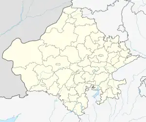
 Bichhiwara Location in Rajasthan, India  Bichhiwara Bichhiwara (India) | |
| Coordinates: 23°47′12″N 073°31′23″E | |
| Country | India |
| State | Rajasthan |
| District | Dungarpur district |
| Tehsil | Bichiwara |
| Languages | |
| • Official | Hindi |
| Time zone | UTC+5:30 (IST) |
| PIN | 314801 |
| ISO 3166 code | RJ-IN |
There are three villages in the gram panchayat: Bichhiwara, Devpura and Nayagaon Punali.[3]
Demographics
At the 2001 census, the village of Bichhiwara had 4000 inhabitants, with 2,050 males (51.2%) and 1,950 females (48.8%).[8] By the 2011 census it had grown to 4,836 inhabitants, with 2,485 males (51.4%) and 2,351 females (48.6%).[9][10]
Notes and references
- 2011 Village Panchayat Code = 33407, "Reports of National Panchayat Directory: Village Panchayat Names of Bichiwara, Dungarpur, Rajasthan". Ministry of Panchayati Raj, Government of India. Archived from the original on 17 April 2015. Retrieved 17 April 2015.
- 2001 Census Village code = 03297300, "2001 Census of India: List of Villages by Tehsil: Rajasthan" (PDF). Registrar General & Census Commissioner, India. p. 654. Archived (PDF) from the original on 13 November 2011.
- 2011 Census Village code = 097540, "Reports of National Panchayat Directory: List of Census Villages mapped for: Bichhiwara Gram Panchayat, Bichiwara, Dungarpur, Rajasthan". Ministry of Panchayati Raj, Government of India. Archived from the original on 17 April 2015. Retrieved 17 April 2015.
- "District Wise Health Facilities: District Map: Dungarpur District". National Health Mission (NHM), Government of Rajastha. Archived from the original on 19 March 2015.
- "Bechhiwara Railway Station Timeline - Railway Enquiry". indiarailinfo.com. Retrieved 10 August 2021.
- "Location Map of Bechhiwara Railway Station". Maps of India.
- "BHWA/Bechhiwara". India Rail. Archived from the original on 7 May 2013.
- "Census 2001 Population Finder: Rajasthan: Dungarpur: Dungarpur: Bichhiwara". Office of The Registrar General & Census Commissioner, Ministry of Home Affairs, Government of India. Archived from the original on 17 April 2015.
- Census 2011 Code 097537 "Census 2011 Population Finder: Rajasthan: Dungarpur: Dungarpur: Bichhiwara". Office of The Registrar General & Census Commissioner, Ministry of Home Affairs, Government of India. Archived from the original on 17 April 2015.
- "Bichhiwara Population - Dungarpur, Rajasthan". Census 2011. Archived from the original on 17 April 2015.
External links
- "Official Website of Dungarpur District". Archived from the original on 18 December 2014.