Biledulgerid
Biledulgerid (Arabic: بلاد الجريد, Bilād al-Jarīd, "Country of Dates")[1] was formerly a country in Northern Africa, south of Mount Atlas, bounded on the north by Tunis, on the west by Algiers and the Sahara, on the east by Tripoli, supposed to be about 180 square miles (470 km2).[1] Carey listed Biledulgerid as 2,500 miles in length and 350 miles in breadth with a population of 3.5 million.[2] Amezrou ("Dara"), Tafilalt, and Sijilmasa were held by Morocco; the Tuggurt Oasis by Ottoman Algeria; Tozeur by Ottoman-aligned Tunis; and Ghadames, the Ouled Boughanem, and the Mosselemis were independent.[1] The population was Berber, black Africans, and Arab,[1] believed to be Muslims, Christian, and Jewish.[2]
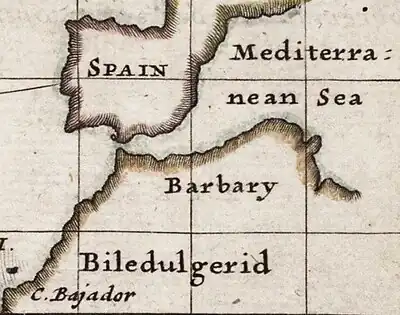
Biledulgerid on Herman Moll's "A View of ye General and Coasting Trade-Winds..." (c. 1715)
See also
References
Citations
- Enc. Am. (1830).
- Carey (1792), p. 53.
Bibliography
- Lieber, Francis; et al., eds. (1830), "Biledulgerid", Encyclopaedia Americana... on the Basis of the Seventh Edition of the German Conversations-Lexicon, vol. II, Philadelphia: Carey & Lea, p. 103.
- Carey, William (1792), An Enquiry into the Obligation of Christians to Use Means for the Conversion of the Heathens... (PDF), Leicester: Ann Ireland
This article is issued from Wikipedia. The text is licensed under Creative Commons - Attribution - Sharealike. Additional terms may apply for the media files.