Bolivar, Missouri
Bolivar is a city and county seat of Polk County, Missouri, United States.[4] As of a 2019 estimate by the U. S. Census Bureau, the city population was 11,067.[5]
Bolivar, Missouri | |
|---|---|
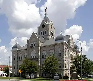 Polk County Courthouse, 2004 | |
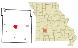 Location of Bolivar, Missouri | |
| Coordinates: 37°36′22″N 93°25′05″W | |
| Country | United States |
| State | Missouri |
| County | Polk |
| Area | |
| • Total | 8.24 sq mi (21.34 km2) |
| • Land | 8.22 sq mi (21.29 km2) |
| • Water | 0.02 sq mi (0.05 km2) |
| Elevation | 1,070 ft (330 m) |
| Population (2020) | |
| • Total | 10,679 |
| • Density | 1,298.99/sq mi (501.57/km2) |
| Time zone | UTC-6 (Central (CST)) |
| • Summer (DST) | UTC-5 (CDT) |
| ZIP codes | 65613, 65727 |
| Area code | 417 |
| FIPS code | 29-06976[3] |
| GNIS feature ID | 2394216[2] |
| Website | Bolivar, Missouri |
History
Bolivar began as a settlement around Keeling Spring, with the majority of settlers being from Hardeman County, Tennessee. The settlement became part of Greene County, Missouri when that county was organized in 1833. After the northern part of Greene County was ceded to form Polk County, Missouri, the Polk County Court proclaimed the settlement as a city, named it Bolivar, and designated it as the county seat on 10 November 1835. Bolivar was re-organized as a fourth-class city on 15 February 1881.[6]
Bolivar experienced growth in 1884 when the St. Louis–San Francisco Railway was extended to that point.[7]
The name "Bolivar" was proposed by John Polk Campbell and his brothers William St. Clair and Ezekiel Madison. It is named after Bolivar, Tennessee, where their grandfather and Continental Army Colonel Ezekiel Polk had lived. In the 1830s, both Polk and Bolivar were names locally associated with liberation. As such, Bolivar, Missouri is an indirect namesake of Simón Bolívar.[8]
The Bolivar Public Library, First National Bank, and North Ward School are listed on the National Register of Historic Places.[9][10][11]
Geography
Bolivar is located in Marion Township. According to the United States Census Bureau, the city has a total area of 8.30 square miles (21.50 km2), of which 8.28 square miles (21.45 km2) is land and 0.02 square miles (0.05 km2) is water.[12]
Climate
| Climate data for Bolivar, Missouri (1991–2020 normals, extremes 1900–present) | |||||||||||||
|---|---|---|---|---|---|---|---|---|---|---|---|---|---|
| Month | Jan | Feb | Mar | Apr | May | Jun | Jul | Aug | Sep | Oct | Nov | Dec | Year |
| Record high °F (°C) | 77 (25) |
86 (30) |
90 (32) |
93 (34) |
100 (38) |
104 (40) |
115 (46) |
108 (42) |
108 (42) |
98 (37) |
87 (31) |
77 (25) |
115 (46) |
| Average high °F (°C) | 42.8 (6.0) |
47.9 (8.8) |
57.5 (14.2) |
67.6 (19.8) |
75.9 (24.4) |
84.3 (29.1) |
89.1 (31.7) |
88.4 (31.3) |
81.0 (27.2) |
69.8 (21.0) |
57.1 (13.9) |
46.4 (8.0) |
67.3 (19.6) |
| Daily mean °F (°C) | 32.2 (0.1) |
36.6 (2.6) |
45.8 (7.7) |
55.5 (13.1) |
65.1 (18.4) |
73.7 (23.2) |
78.0 (25.6) |
76.8 (24.9) |
68.8 (20.4) |
57.1 (13.9) |
45.7 (7.6) |
36.1 (2.3) |
56.0 (13.3) |
| Average low °F (°C) | 21.7 (−5.7) |
25.4 (−3.7) |
34.0 (1.1) |
43.5 (6.4) |
54.2 (12.3) |
63.0 (17.2) |
67.0 (19.4) |
65.2 (18.4) |
56.6 (13.7) |
44.5 (6.9) |
34.3 (1.3) |
25.7 (−3.5) |
44.6 (7.0) |
| Record low °F (°C) | −25 (−32) |
−19 (−28) |
−7 (−22) |
16 (−9) |
21 (−6) |
39 (4) |
44 (7) |
36 (2) |
19 (−7) |
17 (−8) |
−1 (−18) |
−19 (−28) |
−25 (−32) |
| Average precipitation inches (mm) | 2.31 (59) |
2.25 (57) |
3.59 (91) |
4.96 (126) |
5.90 (150) |
4.88 (124) |
4.62 (117) |
3.71 (94) |
4.25 (108) |
3.79 (96) |
3.42 (87) |
2.70 (69) |
46.38 (1,178) |
| Average precipitation days (≥ 0.01 in) | 7.7 | 7.7 | 10.5 | 11.0 | 12.7 | 10.7 | 8.5 | 7.6 | 7.8 | 9.3 | 8.8 | 7.4 | 109.7 |
| Source: NOAA[13][14] | |||||||||||||
Demographics
| Census | Pop. | Note | %± |
|---|---|---|---|
| 1860 | 409 | — | |
| 1870 | 635 | 55.3% | |
| 1880 | 516 | −18.7% | |
| 1890 | 1,485 | 187.8% | |
| 1900 | 1,869 | 25.9% | |
| 1910 | 1,975 | 5.7% | |
| 1920 | 1,980 | 0.3% | |
| 1930 | 2,256 | 13.9% | |
| 1940 | 2,636 | 16.8% | |
| 1950 | 3,482 | 32.1% | |
| 1960 | 3,512 | 0.9% | |
| 1970 | 4,769 | 35.8% | |
| 1980 | 5,919 | 24.1% | |
| 1990 | 6,845 | 15.6% | |
| 2000 | 9,143 | 33.6% | |
| 2010 | 10,325 | 12.9% | |
| 2020 | 10,679 | 3.4% | |
| U.S. Decennial Census | |||
Bolivar is part of the Springfield, Missouri Metropolitan Statistical Area.
2010 census
As of the census[15] of 2010, there were 10,325 people, 3,970 households, and 2,342 families living in the city. The population density was 1,247.0 inhabitants per square mile (481.5/km2). There were 4,432 housing units at an average density of 535.3 per square mile (206.7/km2). The racial makeup of the city was 94.8% White, 1.5% African American, 0.5% Native American, 0.6% Asian, 0.7% from other races, and 1.8% from two or more races. Hispanic or Latino people of any race were 2.5% of the population.
There were 3,970 households, of which 29.2% had children under the age of 18 living with them, 43.3% were married couples living together, 11.6% had a female householder with no husband present, 4.0% had a male householder with no wife present, and 41.0% were non-families. 33.7% of all households were made up of individuals, and 16.2% had someone living alone who was 65 years of age or older. The average household size was 2.29 and the average family size was 2.92.
The median age in the city was 30.3 years. 21.7% of residents were under the age of 18; 20.8% were between the ages of 18 and 24; 22.1% were from 25 to 44; 17.6% were from 45 to 64; and 17.7% were 65 years of age or older. The gender makeup of the city was 46.5% male and 53.5% female.
2000 census
As of the census[3] of 2000, there were 9,143 people, 3,318 households, and 2,067 families living in the city. The population density was 1,458.8 inhabitants per square mile (563.2/km2). There were 3,636 housing units at an average density of 580.1 per square mile (224.0/km2). The racial makeup of the city was 96.50% White, 0.86% African American, 0.60% Native American, 0.38% Asian, 0.04% Pacific Islander, 0.42% from other races, and 1.19% from two or more races. Hispanic or Latino people of any race were 1.40% of the population.
There were 3,318 households, out of which 29.0% had children under the age of 18 living with them, 48.8% were married couples living together, 10.8% had a female householder with no husband present, and 37.7% were non-families. 30.2% of all households were made up of individuals, and 15.0% had someone living alone who was 65 years of age or older. The average household size was 2.34 and the average family size was 2.89.
In the city, the population was spread out, with 20.8% under the age of 18, 23.9% from 18 to 24, 22.1% from 25 to 44, 14.7% from 45 to 64, and 18.6% who were 65 years of age or older. The median age was 29 years. For every 100 females, there were 83.6 males. For every 100 females age 18 and over, there were 78.7 males.
The median income for a household in the city was $24,609, and the median income for a family was $35,716. Males had a median income of $25,731 versus $18,618 for females. The per capita income for the city was $13,654. About 11.0% of families and 19.8% of the population were below the poverty line, including 22.5% of those under age 18 and 11.7% of those age 65 or over.
Education

Bolivar R-I School District operates one primary school, one intermediate school, one middle school, and Bolivar High School.[16]
Southwest Baptist University, a private institution, has been in operation at Bolivar since 1879.[17]
Bolivar has a public library, a branch of the Polk County Library.[18]
Media
- Bolivar Herald-Free Press
Infrastructure
The Bolivar Municipal Airport is located four nautical miles (4.6 mi, 7.4 km) east of Bolivar's central business district.[19]
Intercity bus service to the city is provided by Jefferson Lines.[20]
Notable people
- John Blake, Irish-American soldier, freedom fighter, and lecturer
- Mike Parson, Lt. Governor of Missouri (2017–2018), and Governor (2018–)
References
- "ArcGIS REST Services Directory". United States Census Bureau. Retrieved August 28, 2022.
- U.S. Geological Survey Geographic Names Information System: Bolivar, Missouri
- "U.S. Census website". United States Census Bureau. Retrieved January 31, 2008.
- "Find a County". National Association of Counties. Archived from the original on May 31, 2011. Retrieved June 7, 2011.
- "2010 City Population and Housing Occupancy Status". U.S. Census Bureau. Retrieved February 8, 2012.
- History of Bolivar, Missouri Archived April 7, 2014, at the Wayback Machine
- Earngey, Bill (1995). Missouri Roadsides: The Traveler's Companion. University of Missouri Press. p. 19. ISBN 9780826210210.
- Eaton, David Wolfe (1917). How Missouri Counties, Towns and Streams Were Named. The State Historical Society of Missouri. pp. 342.
- "National Register Information System". National Register of Historic Places. National Park Service. July 9, 2010.
- "National Register of Historic Places Listings". Weekly List of Actions Taken on Properties: 7/11/11 through 7/15/11. National Park Service. July 22, 2011.
- "National Register of Historic Places". Weekly List of Actions Taken on Properties: 10/01/13 through 10/18/13. National Park Service. October 25, 2013.
- "US Gazetteer files 2010". United States Census Bureau. Archived from the original on January 25, 2012. Retrieved July 8, 2012.
- "NowData – NOAA Online Weather Data". National Oceanic and Atmospheric Administration. Retrieved August 2, 2021.
- "Station: Bolivar 1 NE, MO". U.S. Climate Normals 2020: U.S. Monthly Climate Normals (1991-2020). National Oceanic and Atmospheric Administration. Retrieved August 2, 2021.
- "U.S. Census website". United States Census Bureau. Retrieved July 8, 2012.
- "Bolivar R-I School District". Great Schools. Retrieved March 18, 2018.
- "History". Southwest Baptist University. Retrieved March 18, 2018.
- "About us". Polk County Library. Archived from the original on March 18, 2018. Retrieved March 18, 2018.
- FAA Airport Form 5010 for M17 PDF. Federal Aviation Administration. Effective 30 June 2011.
- "Missouri Bus Stops". Retrieved July 21, 2023.
External links
- Official website
- Bolivar Area Chamber of Commerce
- Historic maps of Bolivar in the Sanborn Maps of Missouri Collection at the University of Missouri
Municipalities and communities of Polk County, Missouri, United States | ||
|---|---|---|
| Cities |  Map of Missouri highlighting Polk County | |
| Villages | ||
| Townships | ||
| Unincorporated communities | ||
| Ghost towns | ||