Bonny, Nigeria
Bonny (originally Okoloama) is a traditional, coastal town and a Local Government Area in Rivers State in southern Nigeria, on the Bight of Bonny. It is also the capital of the Kingdom of Bonny. Traditionally (especially between the 15th and 19th centuries) it was a major trading post of the eastern Delta, especially active in the sale of enslaved people.[2] Bonny Island is a major export point for oil today.[3] The local language spoken in Bonny is Ubani, which is an Ijaw language.
Bonny
Okoloama | |
|---|---|
Kingdom | |
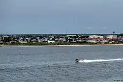 Bonny panoramic | |
 Bonny | |
| Coordinates: 4°26′N 7°10′E | |
| Country | |
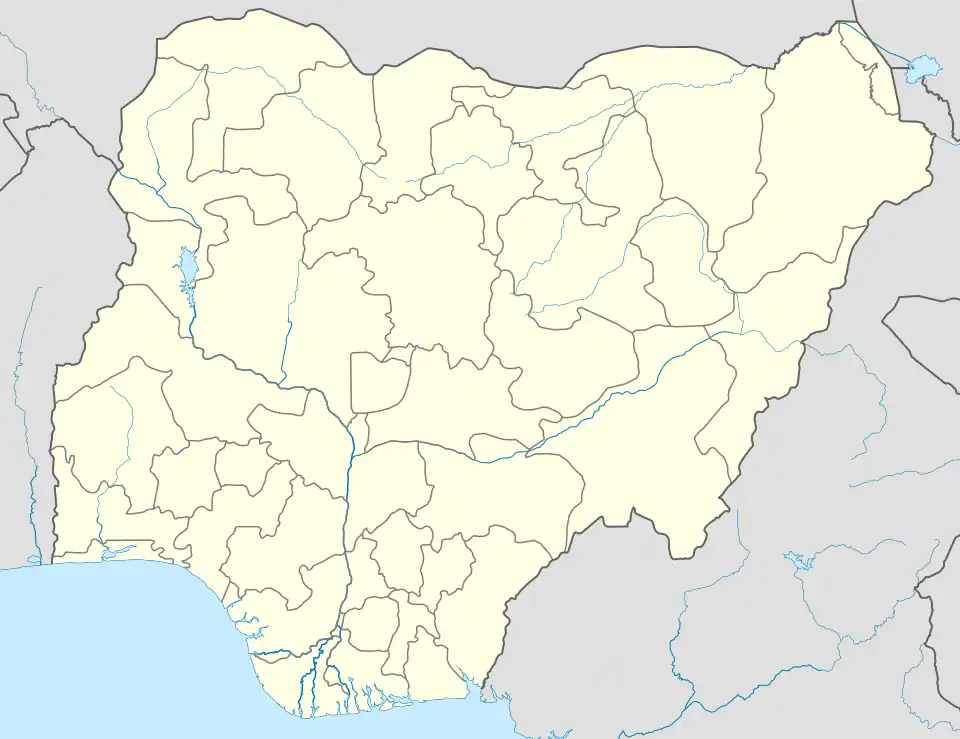
| State | Rivers State |
| Government | |
| • Local Government Chairman | Anengi Barasua (PDP) |
| • Deputy Local Government Chairman | Vacant |
| • Local Government Council | Ward 1: Ibienimi Geoffrey Allison (PDP) Ward 2: Kelvin Pepple (PDP) Ward 3: Fiberesima Pepple (PDP) Ward 4: Dipinye Nelson Jumbo (PDP) Ward 5: Ene Tomintoul (PDP) Ward 6: Erefagha Allaputa (PDP) Ward 7: Ibaningo Larry (PDP) Ward 8: Daniel Green (PDP) Ward 9: Godswill Pepple (PDP) Ward 10: Kingsley Tamy Jumbo (PDP) Ward 11: Patience Anetor Johnson Green (PDP) Ward 12: Marvellous Briston (PDP) |
| Area | |
| • Total | 249.27 sq mi (645.60 km2) |
| Population (2006) | |
| • Total | 214,983[1] |
| Time zone | UTC+1 (WAT) |
The region produces a type of crude oil known as Bonny Light oil. Much of the oil extracted onshore in Rivers State is piped to Bonny for export. It has the biggest LNG Gas Plant in Nigeria with six (6) trains. Currently, the Federal Government of Nigeria has set plans for the construction of the 7th train of the NLNG to boost its gas production in anticipation of dominating the African market.
Bonny has a bridge being constructed from Bodo in Gokana LGA to enable land transportation. A deep seaport is underway as a corporate social responsibility project from CCECC.
Kingdom of Bonny
The Kingdom of Bonny was a sovereign state in the Niger Delta. It is currently one of Nigeria's traditional states.
The original first settlement, which began as a small town, was called Okoloama, a name taken from the Okulo (or Curlews) that inhabited the island in large numbers.[4]
A popular origin myth states that the founders of the island were originally Ijaw people from modern Bayelsa State. They were from the Isedani lineage of Kolokuma in the Ebeni-toru region (in the present day Kolokuma/Opokuma Local Government Area of Bayelsa). The first king of their kingdom, called Ndoli, founded the state before or about 1000 AD. The Ibanis identify as Ijaws today.[5]
The Kingdom of Bonny was powerful beginning in the 15th century with the advent of the Portuguese and the following Atlantic slave trade. In the 19th century, it came under increasing pressure from the British to end the trade. It collapsed in the subsequent Bonny civil war of 1869.[6] A remnant of it continues to exist, however, as a part of the contemporary aristocratic structure of Nigeria.
Presently, Bonny Kingdom is subdivided into two main segments – the mainland and the hinterland. The mainland comprises Bonny Island that has both Okoloma and Finima and their segments, namely the Main Island (Township), Sandfield, Iwoama, Orosikiri, Aganya, Ayambo, Akiama, Isilegono, New Road, Wilbross pipeline, Workers Camp, and some outlying fishing settlements lying along the Bonny River’s coastline. The hinterland includes the village communities such as Kuruma, Fibiri, Oloma, Ayama, Kalaibiama, Ifoko, Sangamabie, Abalamabie and Oloma.
See also
References
- "population at LGAs in geohive.com". Archived from the original on 2013-10-19. Retrieved 2013-04-07.
- "Bonny". Britannica Online Encyclopedia. Retrieved 2009-01-28.
- Frynas, Jedrzej Georg (2000). Oil in Nigeria: Community Rights and Corporate Dominance in Conflict. LIT Verlag Berlin-Hamburg-Münster. p. 79. ISBN 3-8258-3921-4.
- Leonard, Arthur Glyn (1906). The lower Niger and its tribes. London, New York: Macmillan.
- "Attractions, Activities and History of Bonny Island". finelib.com. Retrieved July 22, 2023.
- Alagoa, E. J. (1971). Nineteenth Century Revolutions in the Eastern Delta states and Calabar. Journal of Historical Society of Nigeria 5(4). pp. 565–570.
External links
- Bonny at Encyclopædia Britannica
- Bonny at Encyclopedia.com
- King Jaja of Opobo at Black History Pages
Local government areas of Rivers State | ||
|---|---|---|
| LGAs |  | |