Borysławka (tributary of Wiar)
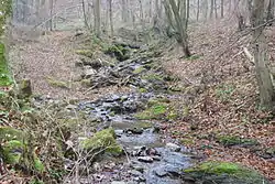
Borysławka is a stream in Poland, which flows within the village of Borysławka (now Gmina Fredropol, Przemyśl County, Podkarpackie Voivodeship, Poland). The stream is depicted on the map by Friedrich von Mieg of the 18th century.[1]
| Borysławka Бориславка | |
|---|---|
 | |
| Location | |
| Country | Poland |
| Physical characteristics | |
| Source | |
| • location | Borysławka, Przemyśl County, Subcarpathian Voivodeship, Poland |
| Mouth | Wiar |
• coordinates | 49°39′47″N 22°37′46″E |
It flows out from under the Turnica mountain range; it flows north through Borysławka and flows opposite the Posada Rybotycka into the Wiar, a tributary of the San.[2]
References
- Europe in the XVIII. century, Military survey Habsburg Empire.
- "Borysławka, 1". Geographical Dictionary of the Kingdom of Poland (in Polish). 1. Warszawa: Kasa im. Józefa Mianowskiego. 1880. p. 334.
External links
- Borysławka, voda.oma.sk
This article is issued from Wikipedia. The text is licensed under Creative Commons - Attribution - Sharealike. Additional terms may apply for the media files.