Brighstone Down
Brighstone Down is a chalk down on the Isle of Wight. It is located close to the village of Brighstone, in the southwest of the island (the Back of the Wight), and rises to 214 metres (702 ft) at its highest point,[1] northeast of the village of Mottistone. Towards the west part is called Mottistone Down, to the East, Shorwell Down.
| Brighstone Down | |
|---|---|
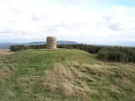 Toposcope on the summit | |
| Highest point | |
| Elevation | 214 m (702 ft) |
| Prominence | c. 150 m |
| Parent peak | St Boniface Down |
| Listing | Marilyn |
| Geography | |
| Location | Isle of Wight, England |
| OS grid | SZ432847 |
| Topo map | OS Landranger 196 |
The Northern part is covered by Brighstone Forest the largest forest on the Island. [2]
On 19 November 1947, an BOAC Short S.25 Sunderland 3 (G-AGHW) was on a ferry flight from Hythe Seaplane Base to Poole Seaplane Base. The aircraft crashed into Brighstone Down in bad weather, as a result of pilot error, killing one of the four crew.[3]
| Unitary authorities | |
|---|---|
| Major settlements (cities in italics) | |
| Rivers | |
| Topics | |
Notes
- "Brighstone Down". Peakery. Retrieved 8 August 2015.
- http://www.iwpaths.co.uk/sota/actual_sota_brighstone_down.php%5B%5D
- "19 November 1947 Short S.25 Sunderland 3." Aviation Safety Network. Retrieved 9 October 2021.
This article is issued from Wikipedia. The text is licensed under Creative Commons - Attribution - Sharealike. Additional terms may apply for the media files.