Broxton, Georgia
Broxton is a city in Coffee County, Georgia, United States. Per the 2020 census, the population was 1,060.[4] It is known for its unique sandstone formation called Broxton Rocks along Rocky Creek 10 miles (16 km) north of town.
Broxton, Georgia | |
|---|---|
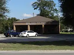 Broxton Post Office | |
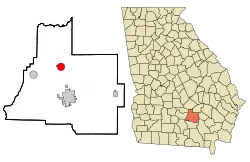 Location in Coffee County and the state of Georgia | |
| Coordinates: 31°37′39″N 82°53′23″W | |
| Country | United States |
| State | Georgia |
| County | Coffee |
| Area | |
| • Total | 3.36 sq mi (8.70 km2) |
| • Land | 3.25 sq mi (8.41 km2) |
| • Water | 0.11 sq mi (0.29 km2) |
| Elevation | 285 ft (87 m) |
| Population (2020) | |
| • Total | 1,060 |
| • Density | 326.56/sq mi (126.07/km2) |
| Time zone | UTC-5 (Eastern (EST)) |
| • Summer (DST) | UTC-4 (EDT) |
| ZIP code | 31519 |
| Area code | 912 |
| FIPS code | 13-11504[2] |
| GNIS feature ID | 0354876[3] |
| Website | www |
History
An early variant name was "Gully Branch".[5] The Georgia General Assembly incorporated the place as the "Town of Broxton" in 1904, with the corporate limits extending in a one-mile (1.6 km) radius from the front-yard well of one Jesse Lott.[6] The present name is after Broxton Creek.[5]
Geography
Broxton is located in north-central Coffee County at 31°37′39″N 82°53′23″W (31.627415, -82.889709).[7] U.S. Route 441 passes through the city, leading south 9 miles (14 km) to Douglas, the county seat, and north 33 miles (53 km) to McRae.
According to the United States Census Bureau, Broxton has a total area of 3.4 square miles (8.7 km2), of which 3.2 square miles (8.4 km2) is land and 0.12 square miles (0.3 km2), or 3.58%, is water.[8]
Demographics
| Census | Pop. | Note | %± |
|---|---|---|---|
| 1900 | 300 | — | |
| 1910 | 1,040 | 246.7% | |
| 1920 | 696 | −33.1% | |
| 1930 | 830 | 19.3% | |
| 1940 | 908 | 9.4% | |
| 1950 | 890 | −2.0% | |
| 1960 | 907 | 1.9% | |
| 1970 | 957 | 5.5% | |
| 1980 | 1,117 | 16.7% | |
| 1990 | 1,211 | 8.4% | |
| 2000 | 1,428 | 17.9% | |
| 2010 | 1,189 | −16.7% | |
| 2020 | 1,060 | −10.8% | |
| U.S. Decennial Census[9] 2010[10] 2020[11] | |||
2020 census
| Race / Ethnicity | Pop 2010[10] | Pop 2020[11] | % 2010 | % 2020 |
|---|---|---|---|---|
| White alone (NH) | 558 | 451 | 46.93% | 42.55% |
| Black or African American alone (NH) | 499 | 445 | 41.97% | 41.98% |
| Native American or Alaska Native alone (NH) | 2 | 0 | 0.17% | 0.00% |
| Asian alone (NH) | 6 | 0 | 0.50% | 0.00% |
| Pacific Islander alone (NH) | 0 | 0 | 0.00% | 0.00% |
| Some Other Race alone (NH) | 0 | 2 | 0.00% | 0.19% |
| Mixed Race/Multi-Racial (NH) | 11 | 44 | 0.93% | 4.15% |
| Hispanic or Latino (any race) | 113 | 118 | 9.50% | 11.13% |
| Total | 1,189 | 1,060 | 100.00% | 100.00% |
Note: the US Census treats Hispanic/Latino as an ethnic category. This table excludes Latinos from the racial categories and assigns them to a separate category. Hispanics/Latinos can be of any race.
2000 census
As of the census[2] of 2000, there were 1,428 people, 527 households, and 363 families residing in the city. The population density was 440.8 inhabitants per square mile (170.2/km2). There were 612 housing units at an average density of 188.9 per square mile (72.9/km2). The racial makeup of the city was 42.65% White, 50.35% African American, 0.28% Native American, 5.67% from other races, and 1.05% from two or more races. Hispanic or Latino of any race were 7.49% of the population.
There were 527 households, out of which 38.7% had children under the age of 18 living with them, 41.2% were married couples living together, 23.0% had a female householder with no husband present, and 31.1% were non-families. 27.5% of all households were made up of individuals, and 14.4% had someone living alone who was 65 years of age or older. The average household size was 2.68 and the average family size was 3.28.
In the city, the population was spread out, with 32.1% under the age of 18, 9.2% from 18 to 24, 27.8% from 25 to 44, 19.8% from 45 to 64, and 11.1% who were 65 years of age or older. The median age was 31 years. For every 100 females, there were 86.7 males. For every 100 females age 18 and over, there were 77.5 males.
The median income for a household in the city was $22,900, and the median income for a family was $26,211. Males had a median income of $24,408 versus $19,226 for females. The per capita income for the city was $11,984. About 22.0% of families and 26.9% of the population were below the poverty line, including 34.0% of those under age 18 and 25.0% of those age 65 or over.
References
- "2020 U.S. Gazetteer Files". United States Census Bureau. Retrieved December 18, 2021.
- "U.S. Census website". United States Census Bureau. Retrieved January 31, 2008.
- "US Board on Geographic Names". United States Geological Survey. October 25, 2007. Retrieved January 31, 2008.
- "Broxton city, Georgia". United States Census Bureau. Retrieved April 15, 2022.
- Krakow, Kenneth K. (1975). Georgia Place-Names: Their History and Origins (PDF). Macon, GA: Winship Press. p. 27. ISBN 0-915430-00-2.
- Acts and Resolutions of the General Assembly of the State of Georgia. Clark & Hines, State Printers. 1904. p. 368.
- "US Gazetteer files: 2010, 2000, and 1990". United States Census Bureau. February 12, 2011. Retrieved April 23, 2011.
- "Geographic Identifiers: 2010 Demographic Profile Data (G001): Broxton city, Georgia". U.S. Census Bureau, American Factfinder. Archived from the original on February 12, 2020. Retrieved July 29, 2014.
- "Decennial Census of Population and Housing by Decades". US Census Bureau.
- "P2 HISPANIC OR LATINO, AND NOT HISPANIC OR LATINO BY RACE – 2010: DEC Redistricting Data (PL 94-171) – Broxton city, Georgia". United States Census Bureau.
- "P2 HISPANIC OR LATINO, AND NOT HISPANIC OR LATINO BY RACE – 2020: DEC Redistricting Data (PL 94-171) – Broxton city, Georgia". United States Census Bureau.
Municipalities and communities of Coffee County, Georgia, United States | ||
|---|---|---|
| Cities | 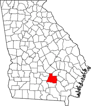 Map of Georgia highlighting Coffee County | |
| Unincorporated communities | ||