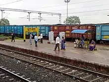
Butibori
Butibori is an industrial suburb of Nagpur, India and is developed as 5 Star Industrial district by Maharashtra Industrial Development Corporation (MIDC). Butibori's total area acquired is 23.12 square kilometres out of which 14.94 km² is developed.[1] The area is developed economic development of Nagpur city. The area receives water supply from Wadgaon Dam. Butibori also claims Maharashtra's first Food-Park. In order to invite textile industries a common effluent treatment plant is also built.[2] Maharashtra Industries Development Corporation has acquired additional 3,750 acres.[3] Butibori is named after the Buti family of Nagpur.
Butibori | |
|---|---|
Industrial Suburb | |
 Butibori Location in Maharashtra, India | |
| Coordinates: 20°56′01″N 79°00′08″E | |
| Country | |
| State | Maharashtra |
| District | Nagpur |
| Area | |
| • Total | 8 km2 (3 sq mi) |
| Population (2011) | |
| • Total | 12,072 |
| • Density | 1,500/km2 (3,900/sq mi) |
| Languages | |
| • Official | Marathi |
| Time zone | UTC+5:30 (IST) |
| PIN | 441108 |
| Telephone code | 07103 |
| Vehicle registration | MH-40 |
| Nearest city | Hingna |
| Sex ratio | 914:1000 ♂/♀ |
| Literacy | 91% |
| Lok Sabha constituency | Ramtek (Lok Sabha constituency) |
| Vidhan Sabha constituency | Hingna Assembly region |

It is served by the Buti Bori railway station.
The number of industries operating in the area is around 100, with around 35 under construction. Butibori Industrial Area spans a total area of 1,500 hectares.[4]
See also
References
- "MIDC profile of Butibori". Archived from the original on 5 March 2007. Retrieved 6 March 2008.
- "Butibori advantage". Archived from the original on 26 February 2008. Retrieved 6 March 2008.
- "Rs 500 cr released for Butibori expansion - Times of India". The Times of India.
- "Maharastra Industrial Development Corporation, India". Archived from the original on 4 August 2012. Retrieved 8 January 2012.
5. Butibori First News Update Portal Aamchibutiborinews