Conyca Geodrone
The Conyca Geodrome is a 1.5m fixed-wing drone that specializes in topography and photogrammetric applications. It has all the legal requirements to operate in Spain. The system has totally autonomous take-off and landing operations, can present 3D terrain models with 4 cm resolution accuracy at 100 m height, and can take orthophotos. Although this system has been orientated to topography, there are surveillance and precision agriculture versions than can use infrared and hyperspectral cameras.
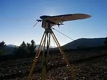
Geodrone working on The mestas. Doing the 3d terrain model of a mountain road.
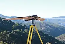
Geodrone working on The mestas. Doing the 3d terrain model of a mountain road.
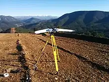
Geodrone working on The mestas. Doing the 3d terrain model of a mountain road.
Specifications
External links
This article is issued from Wikipedia. The text is licensed under Creative Commons - Attribution - Sharealike. Additional terms may apply for the media files.