Campbell's Covered Bridge
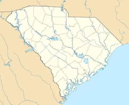
Campbell's Covered Bridge is a wooden covered bridge in northeastern Greenville County, South Carolina, near the small town of Gowensville,[2][3] and crosses Beaverdam Creek off Pleasant Hill Road.[4]
Campbell's Covered Bridge | |
|---|---|
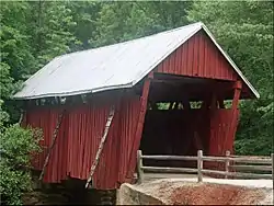
 A photo of Campbell's Covered Bridge near Gowensville, South Carolina. | |
| Coordinates | 35°5′9″N 82°15′51″W |
| Carries | 123 Campbell Covered Bridge Rd. |
| Crosses | Beaverdam Creek |
| Locale | Gowensville, Greenville County, South Carolina |
| Characteristics | |
| Design | Covered bridge |
| Total length | 38 ft (12 m) |
| Width | 12 ft (3.7 m) |
| History | |
| Construction end | 1909 |
Campbell's Covered Bridge | |
  | |
| Location | 123 Campbell Covered Bridge Rd., Gowensville, South Carolina |
| Area | less than one acre |
| Built | 1909 |
| Architectural style | Howe truss |
| NRHP reference No. | 09000483[1] |
| Added to NRHP | July 1, 2009 |
| Location | |
Campbell's Covered Bridge is the last remaining covered bridge in South Carolina.[5] It is owned by Greenville County, which closed it to motorized traffic in the early 1980s.[6] The bridge was added to the National Register of Historic Places on July 1, 2009.[1]
History
The bridge was built in 1909 by Charles Irwin Willis (1878–1966)[7] and was named for grist mill owner Alexander Lafayette Campbell (1836–1920), who built and maintained the nearby mill for many years,[7] portions of which remain.[6]
The Campbell bridge has been restored twice, first in 1964 by the Crescent Garden Club,[4] and then in 1990.[8]
The land surrounding the bridge was owned by Sylvia Pittman from 1991 until 2008, when she sold 10 acres (40,000 m2) to the Greenville County Recreation District. She said, "I had in mind to have a park preserve this to let everyone enjoy this like we have." The US$180,000 for creating the park was covered by state and county grants.[6] [9]
Structure
The Campbell's bridge is 38 feet (12 m) long and 12 feet (3.7 m) wide.[4] It was constructed in the relatively rare four-span, Howe truss design and features vertical iron rods and diagonal pine timbers.[10]
References
- "National Register Information System". National Register of Historic Places. National Park Service. July 9, 2010.
- Brown, Weylin; Dean Campbell (March 14, 2009). "Campbell's Covered Bridge" (PDF). National Register of Historic Places - Nomination and Inventory. Retrieved 8 July 2012.
- "Campbell's Covered Bridge, Greenville County (123 Campbell Covered Bridge Rd., Gowensville vicinity)". National Register Properties in South Carolina. South Carolina Department of Archives and History. Retrieved 8 July 2012.
- "Designated Sites - Campbell Covered Bridge". Greenville County Historic Preservation Commission. Archived from the original on 2009-01-05. Retrieved 2008-10-07.
- "Gowensville, South Carolina – Campbell Covered Bridge". South Carolina Information Highway. Retrieved 2008-10-02.
- "Covered Bridge To Become Centerpiece Of New Park". WYFF. 2005-04-14. Archived from the original on 2011-05-22. Retrieved 2008-10-03.
- "Campbell's Covered Bridge (23-25)". Waymarking.com. 2006-06-23. Retrieved 2008-10-02.
- John F. Clark; Patricia A. Pierce (2003). Scenic Driving South Carolina. Globe Pequot. p. 40. ISBN 9780762711390. Retrieved 2008-10-07.
- Greenville Rec wayside marker at site.
- Scott Cochran (2007). Motorcycle Journeys Through the American South. Springer Science & Business. p. 234. ISBN 9781884313615. Retrieved 2008-10-04.
External links
![]() Media related to Campbell's Covered Bridge at Wikimedia Commons
Media related to Campbell's Covered Bridge at Wikimedia Commons

