Campo Elías Municipality
The Campo Elías Municipality is one of the 23 municipalities
Campo Elías Municipality
Municipio Campo Elías | |
|---|---|
 Flag  Seal | |
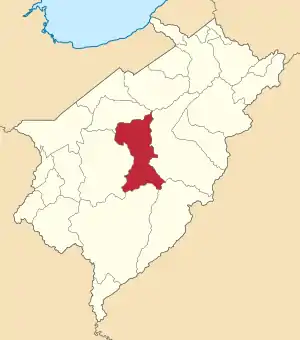 Location in Mérida | |
.svg.png.webp) Campo Elías Municipality Location in Venezuela | |
| Coordinates: 8°27′00″N 71°17′00″W | |
| Country | |
| State | Mérida |
| Municipal seat | Ejido |
| Government | |
| • Mayor | Jesús Antonio Abreu Uzcátegui (MVR) |
| Area | |
| • Total | 609 km2 (235 sq mi) |
| Population (2007) | |
| • Total | 100,192 |
| • Density | 160/km2 (430/sq mi) |
| Time zone | UTC−4 (VET) |
| Area code(s) | 0274 |
| Website | Official website |
(municipios) that makes up the Venezuelan state of Mérida and according to a 2007 population estimate by the National Institute of Statistics of Venezuela, the municipality has a population of 100,192.[1] The town of Ejido is the shire town of the Campo Elías Municipality.[2]
Demographics
The Campo Elías Municipality, according to a 2007 population estimate by the National Institute of Statistics of Venezuela, has a population of 100,192 (up from 84,476 in 2000). This amounts to 11.9% of the state's population.[3] The municipality's population density is 164.5 inhabitants per square kilometre (426/sq mi).[4]
Government
The mayor of the Campo Elías Municipality is Jesús Antonio Abreu Uzcátegui, re-elected on October 31, 2004 with 61% of the vote.[5][6] The municipality is divided into seven parishes; Fernández Peña, Matriz, Montalbán, Acequias, Jají, La Mesa, and San José del Sur.[2]
References
- http://www.ine.gob.ve/sintesisestadistica/estados/merida/cuadros/Poblacion6.xls
- http://www.ine.gob.ve/secciones/division/Merida.zip
- http://www.ine.gob.ve/sintesisestadistica/estados/merida/cuadros/Poblacion5.xls
- http://www.ine.gob.ve/sintesisestadistica/estados/merida/cuadros/Poblacion4.xls
- http://www.cne.gob.ve/regionales2004/12/alcaldedis=0&edo=12&mun=4&par=0&cen=0&mesa=0&cua=0.html
- "Archived copy" (PDF). Archived from the original (PDF) on 2006-10-02. Retrieved 2008-03-15.
{{cite web}}: CS1 maint: archived copy as title (link)