City of Canning
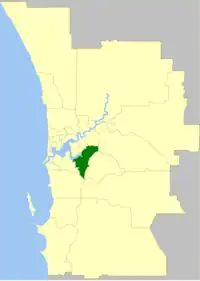
The City of Canning is a local government area in the southeastern suburbs of the Western Australian capital city of Perth, about 10 kilometres (6 mi) southeast of Perth's central business district. The City covers an area of 64.8 square kilometres (25.0 sq mi) and had a population of approximately 90,000 as at the 2016 Census.
| City of Canning Western Australia | |||||||||||||||
|---|---|---|---|---|---|---|---|---|---|---|---|---|---|---|---|
 The City of Canning within the Perth Metropolitan Area | |||||||||||||||
| Population | 95,860 (LGA 2021)[1] | ||||||||||||||
| Established | 1871 | ||||||||||||||
| Area | 64.8 km2 (25.0 sq mi) | ||||||||||||||
| Mayor | Patrick Hall | ||||||||||||||
| Council seat | Cannington | ||||||||||||||
| Region | South East Metropolitan Perth | ||||||||||||||
| State electorate(s) | Cannington, Victoria Park, Belmont, Riverton, Southern River | ||||||||||||||
| Federal division(s) | Swan, Tangney, Canning | ||||||||||||||
 | |||||||||||||||
| Website | City of Canning | ||||||||||||||
| |||||||||||||||
History

A short-lived attempt to create a town trust for the Canning District lasted from 1843-1847, before it was dissolved.[2] The area continued to develop under the control of a Central Board of Works until, in 1871, the Canning Road District was established under the District Roads Act 1871.
The City of Canning originated as the Municipality of Queen's Park, which was established on 1 July 1907 when the original Canning Road District was divided into two and split into the Queen's Park municipality and the Gosnells Road District (later to become the City of Gosnells). It was renamed the Queen's Park Road District on 5 November 1913.[3]
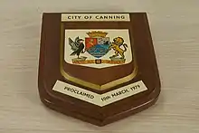
It was renamed again to become the second Canning Road District on 17 June 1921, and received a large amount of land from the abolished Jandakot Road District on 30 November 1923. On 1 July 1961, Canning Road District became the Shire of Canning under the Local Government Act 1960, which reformed all remaining road districts into shires. On 4 December 1970 it gained town status as the Town of Canning and assumed its current name when it gained city status on 10 March 1979.[3][4]
In 1974 the then-Town of Canning brought heritage registered Woodles Homestead to create a local Heritage museum.
In late 2012, an inquiry against the Canning City Council launched by the State Government's Department of Local Government resulted in a 476-page report "pointing to widespread dysfunction, micromanagement and alleged serious governance irregularities."[5] As a result, the State Government ordered the suspension of the Council, appointing Linton Reynolds to replace it as City Commissioner.
Two years later, in mid-September 2014, it was reported that the State Government had sacked the four remaining Canning councillors, to be replaced by a panel of three new Commissioners upon the end of Commissioner Reynolds' tenure on 16 September.[6] As part of the Department of Local Governments' plans, in which the number of local councils would have been reduced drastically, it was announced that the City of Canning would be split up and merged into neighbouring local areas, including the City of Gosnells and City of Melville.[7] Since the failure of the state government's council merger process, the governor's order for the merger has been revoked.[8]
Wards
The city is divided into five wards with each ward electing two councillors while the mayor is directly elected.
- Mason Ward
- Bannister Ward
- Beeliar Ward
- Nicholson Ward
- Beeloo Ward
Suburbs
The suburbs of the City of Canning with population and size figures based on the most recent Australian census:[9][10]
| Suburb | Population | Area | Map |
|---|---|---|---|
| Bentley * | 9,051 (SAL 2021)[11] | 5.4 km2 (2.1 sq mi) | |
| Canning Vale * | 34,504 (SAL 2021)[12] | 25.4 km2 (9.8 sq mi) | |
| Cannington | 6,875 (SAL 2021)[13] | 4.1 km2 (1.6 sq mi) | |
| East Cannington | 6,512 (SAL 2021)[14] | 2.8 km2 (1.1 sq mi) | |
| Ferndale | 4,457 (SAL 2021)[15] | 3.3 km2 (1.3 sq mi) | |
| Leeming * | 10,883 (SAL 2021)[16] | 7.5 km2 (2.9 sq mi) | |
| Lynwood | 3,541 (SAL 2021)[17] | 1.8 km2 (0.69 sq mi) | |
| Parkwood | 5,995 (SAL 2021)[18] | 3.6 km2 (1.4 sq mi) | |
| Queens Park | 7,268 (SAL 2021)[19] | 2.7 km2 (1.0 sq mi) | |
| Riverton | 6,078 (SAL 2021)[20] | 2.7 km2 (1.0 sq mi) | |
| Rossmoyne | 3,638 (SAL 2021)[21] | 1.6 km2 (0.62 sq mi) | |
| St James * | 4,894 (SAL 2021)[22] | 1.8 km2 (0.69 sq mi) | |
| Shelley | 4,795 (SAL 2021)[23] | 2.1 km2 (0.81 sq mi) | |
| Welshpool * | 16 (SAL 2021)[24] | 8.3 km2 (3.2 sq mi) | |
| Willetton | 19,262 (SAL 2021)[25] | 8.7 km2 (3.4 sq mi) | |
| Wilson | 6,608 (SAL 2021)[26] | 3.8 km2 (1.5 sq mi) |
( * indicates suburb partially located within City)
Population
|
|
Heritage-listed places
As of 2023, 107 places are heritage-listed in the City of Canning,[27] of which eight are on the State Register of Heritage Places, among them Castledare Boys' Home and Woodloes Homestead.[28]
Sister cities
Canning also shares a friendship agreement with Fresagrandinaria, Abruzzo, Italy.
References
- Australian Bureau of Statistics (28 June 2022). "Canning (Local Government Area)". Australian Census 2021 QuickStats. Retrieved 28 June 2022.
- TPG (May 2015) City of Canning Heritage Strategy. P4. PDF.
- "Municipality Boundary Amendments Register" (PDF). Western Australian Electoral Distribution Commission. Retrieved 11 January 2020.
- Carden, F.G. (Fred) (1991) [1968]. Along the Canning: A History of the City of Canning Western Australia (2 ed.). Cannington: City of Canning. ISBN 0-646-03234-8.
- Perth's Canning City facing suspension, GovernmentNews Nov 19 2012
- Take two: Canning council sacked again, commissioners appointed, WA Today Sept 16 2012
- "Local Government Reform, City of Canning". Archived from the original on 2 November 2014. Retrieved 2 November 2014.
- "Archived copy" (PDF). Archived from the original (PDF) on 23 September 2015. Retrieved 26 March 2015.
{{cite web}}: CS1 maint: archived copy as title (link) - "SLIP Map". maps.slip.wa.gov.au. Landgate. Retrieved 1 January 2023.
- "NationalMap". nationalmap.gov.au. Geoscience Australia. Retrieved 1 January 2023.
- Australian Bureau of Statistics (28 June 2022). "Bentley (WA) (Suburb and Locality)". Australian Census 2021 QuickStats. Retrieved 28 June 2022.
- Australian Bureau of Statistics (28 June 2022). "Canning Vale (Suburb and Locality)". Australian Census 2021 QuickStats. Retrieved 28 June 2022.
- Australian Bureau of Statistics (28 June 2022). "Cannington (Suburb and Locality)". Australian Census 2021 QuickStats. Retrieved 28 June 2022.
- Australian Bureau of Statistics (28 June 2022). "East Cannington (Suburb and Locality)". Australian Census 2021 QuickStats. Retrieved 28 June 2022.
- Australian Bureau of Statistics (28 June 2022). "Ferndale (WA) (Suburb and Locality)". Australian Census 2021 QuickStats. Retrieved 28 June 2022.
- Australian Bureau of Statistics (28 June 2022). "Leeming (Suburb and Locality)". Australian Census 2021 QuickStats. Retrieved 28 June 2022.
- Australian Bureau of Statistics (28 June 2022). "Lynwood (WA) (Suburb and Locality)". Australian Census 2021 QuickStats. Retrieved 28 June 2022.
- Australian Bureau of Statistics (28 June 2022). "Parkwood (WA) (Suburb and Locality)". Australian Census 2021 QuickStats. Retrieved 28 June 2022.
- Australian Bureau of Statistics (28 June 2022). "Queens Park (WA) (Suburb and Locality)". Australian Census 2021 QuickStats. Retrieved 28 June 2022.
- Australian Bureau of Statistics (28 June 2022). "Riverton (WA) (Suburb and Locality)". Australian Census 2021 QuickStats. Retrieved 28 June 2022.
- Australian Bureau of Statistics (28 June 2022). "Rossmoyne (Suburb and Locality)". Australian Census 2021 QuickStats. Retrieved 28 June 2022.
- Australian Bureau of Statistics (28 June 2022). "St James (WA) (Suburb and Locality)". Australian Census 2021 QuickStats. Retrieved 28 June 2022.
- Australian Bureau of Statistics (28 June 2022). "Shelley (WA) (Suburb and Locality)". Australian Census 2021 QuickStats. Retrieved 28 June 2022.
- Australian Bureau of Statistics (28 June 2022). "Welshpool (WA) (Suburb and Locality)". Australian Census 2021 QuickStats. Retrieved 28 June 2022.
- Australian Bureau of Statistics (28 June 2022). "Willetton (Suburb and Locality)". Australian Census 2021 QuickStats. Retrieved 28 June 2022.
- Australian Bureau of Statistics (28 June 2022). "Wilson (Suburb and Locality)". Australian Census 2021 QuickStats. Retrieved 28 June 2022.
- "City of Canning Heritage Places". inherit.stateheritage.wa.gov.au. Heritage Council of Western Australia. Retrieved 17 February 2023.
- "City of Canning State Register of Heritage Places". inherit.stateheritage.wa.gov.au. Heritage Council of Western Australia. Retrieved 17 February 2023.