Cap Ferret
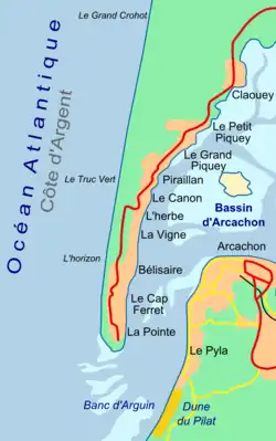
Cap Ferret (French pronunciation: [kap fɛʁɛ]; English: Cape Ferret) is a headland situated at the south end of the commune of Lège-Cap-Ferret in the Gironde department in the French southwestern Nouvelle-Aquitaine region. The headland takes the form of a spit, which separates the Atlantic Ocean from Arcachon Bay. At the same time, the entrance to Arcachon Bay separates Cap Ferret from the resort town of Arcachon.
Cap Ferret | |
|---|---|
 | |
| Coordinates: 44°38′46.28″N 1°14′56.11″W | |
| Location | Nouvelle-Aquitaine, France |
| Offshore water bodies | Atlantic Ocean, Arcachon Bay |
Cap Ferret is famous for its lighthouse and as an up-market resort that has retained its natural feel at the heart of the Landes of Gascony and the Pays de Buch. It is also famous for its ostreicole (oyster-farming) activity and numerous tasting sites.
Cap Ferret is accessible by road from the north, and by passenger ferry from Arcachon. The Tramway du Cap-Ferret, a diesel operated narrow-gauge railway, links the ferry landing at Bélisaire on the shores of Arcachon Bay with the beaches on the Atlantic coast.[1][2][3]
Gallery
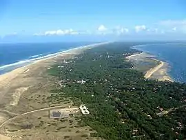
 Cap Ferret looking north
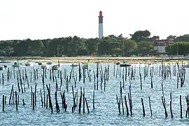
 The lighthouse at Cap Ferret
 The Tramway du Cap-Ferret
References
- "Accès / transport" (in French). Office de tourisme de Lège-Cap Ferret. Archived from the original on 2010-09-27. Retrieved 2010-10-01.
- "Navettes - Arcachon - Cap Ferret" (in French). Union des Bateliers Arcachonnais. Archived from the original on 2010-06-28. Retrieved 2010-10-01.
- "A pied, à vélo, en petit train ..." (in French). Mairie Lege Cap Ferret. Archived from the original on 2009-02-24. Retrieved 2010-10-01.
External links
- (in French) Panoramas of Cap Ferret
- (in French) Official web site of Cap Ferret
- (in French) Discover Cap Ferret in catamaran
- (in English) The lighthouse on the site World Wide Panorama