Caplin Cove-Southport, Newfoundland and Labrador
Caplin Cove-Southport is a local service district and designated place in Trinity Bay in the Canadian province of Newfoundland and Labrador. Caplin Cove-Southport is approximately 50 km from Clarenville.
Caplin Cove-Southport | |
|---|---|
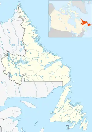
 Caplin Cove-Southport Location within Newfoundland and Labrador  Caplin Cove-Southport Location within Canada | |
| Coordinates: 48.013°N 53.686°W | |
| Country | Canada |
| Province | Newfoundland and Labrador |
| Census division | 7 |
| Census subdivision | M |
| Area | |
| • Land | 26.46 km2 (10.22 sq mi) |
| Population | |
| • Total | 687 |
| Time zone | UTC−03:30 (NST) |
| • Summer (DST) | UTC−02:30 (NDT) |
| Highways | |
Southport
The early settlers were inshore fishing families, but the community also became involved in the Labrador fishery in the 1870s. Early residents traded most catches with merchants in Trinity and visiting trading schooners. By 1890 Henry Alcock of Harbour Grace had established a mercantile business at Southport and nearby Hickman's Harbour had become a local mercantile centre as well.
By 1956, when Southport received its first road connection with the Province's highway system, the population of the community had peaked at approximately 225. By this time, however, the Labrador fishery had died and most fishing was carried out in local waters for cod, turbot, mackerel, herring, capelin and lobster. All cod landings were salted and dried on community flakes for marketing before the mid-1950's at which time fishermen increasingly began selling their catches fresh to local merchants and outside buyers. By this date Southport had become one of the principal centres in Newfoundland for the production of salted or pickled turbot and was a significant mackerel bar seine fishing centre with much of the pickled mackerel product being sold to West Indian markets. Its large output of pickled turbot was sold primarily in the lumber camps of Newfoundland, the Maritimes, Quebec and Maine. In the early 1960s a number of Southport fishermen were amongst the pioneers in the expansion of the groundfish longliner/gillnetter vessel fishery and constructed their own 45'vessels at Southport and also helped pioneer the development of the groundfish gillnet and purse seine pelagic fishery along the province's east/northeast coast for species such as cod, turbot, flounder, capelin, herring and mackerel. By 1992, when the northern cod moratorium was implemented, larger vessels dominated the Southport fishing industry but smaller inshore vessels were still being deployed by some fishing crews. Several of these larger vessels were also venturing as far as the Grand Banks for cod, crab and tuna in the post 1985 period. In the post 1970 period Southport Fish Products and Clarenville Ocean Products operated a multi-species processing/buying facility in the community.
After 1970 a number of Southport families erected homes on the road between Southport and Gooseberry Cove. As of 2020, there are less than 50 permanent residents in the community. Heart's Ease Beach Trail, located near the settlement, is quickly becoming a favorite hiking spot.
Geography
Caplin Cove-Southport is in Newfoundland within Subdivision M of Division No. 7.[2]
Demographics
As a designated place in the 2016 Census of Population conducted by Statistics Canada, Caplin Cove-Southport recorded a population of 687 living in 316 of its 406 total private dwellings, a change of -12.6% from its 2011 population of 786. With a land area of 26.46 km2 (10.22 sq mi), it had a population density of 26.0/km2 (67.2/sq mi) in 2016.[1]
Government
Caplin Cove-Southport is a local service district (LSD)[3] that is governed by a committee responsible for the provision of certain services to the community.[4] The chair of the LSD committee is Valerie Johnson.[3]
See also
References
- "Population and dwelling counts, for Canada, provinces and territories, and designated places, 2016 and 2011 censuses – 100% data (Newfoundland and Labrador)". Statistics Canada. February 7, 2018. Retrieved December 22, 2021.
- "Population and dwelling counts, for Canada, provinces and territories, census divisions, census subdivisions (municipalities) and designated places, 2016 and 2011 censuses – 100% data (Newfoundland and Labrador)". Statistics Canada. February 7, 2018. Retrieved December 23, 2021.
- "Directory of Local Service Districts" (PDF). Government of Newfoundland and Labrador. October 2021. Retrieved January 1, 2022.
- "Local Service Districts – Frequently Asked Questions". Government of Newfoundland and Labrador. Retrieved January 1, 2022.