Caraway Creek (Uwharrie River tributary)
Caraway Creek is a 25.76 mi (41.46 km) long 5th order tributary to the Uwharrie River, in Randolph County, North Carolina.
| Caraway Creek Tributary to Uwharrie River | |
|---|---|
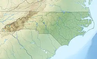
 Location of Caraway Creek mouth  Caraway Creek (Uwharrie River tributary) (the United States) | |
| Location | |
| Country | United States |
| State | North Carolina |
| County | Randolph |
| Physical characteristics | |
| Source | divide between Caraway Creek and Deep River (via Muddy Creek) |
| • location | about 0.25 miles east of Progress, North Carolina |
| • coordinates | 35°52′58″N 079°56′07″W[1] |
| • elevation | 790 ft (240 m)[2] |
| Mouth | Uwharrie River |
• location | about 0.5 miles east of Farmer, North Carolina |
• coordinates | 35°39′14″N 079°57′30″W[1] |
• elevation | 390 ft (120 m)[2] |
| Length | 25.76 mi (41.46 km)[3] |
| Basin size | 98.10 square miles (254.1 km2)[4] |
| Discharge | |
| • location | Uwharrie River |
| • average | 105.77 cu ft/s (2.995 m3/s) at mouth with Uwharrie River[4] |
| Basin features | |
| Progression | Uwharrie River → Pee Dee River → Winyah Bay → Atlantic Ocean |
| River system | Pee Dee |
| Tributaries | |
| • left | Back Creek Taylors Creek |
| • right | Little Caraway Creek |
| Bridges | Old Glenola Road, Creekview Drive, Roy Farlow Road, Old Marlboro Road, Beeson Farm Road, Beckerdite Road, Caraway Mountain Road, Jenco Road, US 64, Ridges Mountain Road, Golden Meadow Road, Old NC 49 |
Course
Caraway Creek rises on the Deep River divide about 0.25 miles (0.40 km) east of Progress in Randolph County, North Carolina. Caraway Creek then flows south to meet the Uwharrie River about 0.5 miles (0.80 km) east of Farmer.[2]
Watershed
Caraway Creek drains 98.10 square miles (254.1 km2) of area, receives about 46.7 inches (1,190 mm) of precipitation annually, has a topographic wetness index of 372.93 and is about 54% forested.[4]
See also
References
- "GNIS Detail - Caraway Creek". geonames.usgs.gov. US Geological Survey. Retrieved 19 November 2019.
- "Caraway Creek Topo Map, Randolph County NC (Farmer Area)". TopoZone. Locality, LLC. Retrieved 19 November 2019.
- "ArcGIS Web Application". epa.maps.arcgis.com. US EPA. Retrieved 19 November 2019.
- "Caraway Creek Watershed Report". Waters Geoviewer. US EPA. Retrieved 19 November 2019.
This article is issued from Wikipedia. The text is licensed under Creative Commons - Attribution - Sharealike. Additional terms may apply for the media files.