Carlisle Bay, Barbados
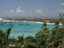
Carlisle Bay is a small natural harbour located in the southwest region of Barbados. The island nation's capital, Bridgetown, is situated on this bay which has been turned into a marine park. Carlisle Bay's marine park is a popular spot on the island for scuba diving. Many relics, like anchors and cannonballs, from ships can be found on the ocean floor in Carlisle Bay.
| Carlisle Bay | |
|---|---|
 Carlisle Bay, Barbados | |
 Carlisle Bay | |
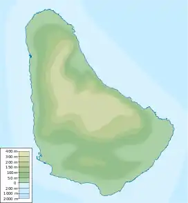
| Location | Southwest coast |
| Coordinates | 13°05′N 59°37′W |
| River sources | Constitution River |
| Ocean/sea sources | Atlantic Ocean |
| Basin countries | Barbados |
| Islands | Barbados, West Indies |
| Settlements | Bridgetown |
The bay takes its name from Barbados' second Lord Proprietor, James Hay, 1st Earl of Carlisle. Lord Carlisle claimed the island[1] through Royal grant on behalf of King Charles I of England in 1627.
Carlisle Bay is home to one of Barbados' historic lighthouses the Needham's Point Lighthouse.
A Dutch fleet led by Michiel de Ruyter during the Second Anglo-Dutch War was repelled by defending English forces in April 1665. During the Second World War a British ship, the Cornwallis, was torpedoed by a German U-Boat, at this location.