Carne, Cornwall
50.082°N 5.116°W Carne is a hamlet in the civil parish of St Anthony-in-Meneage, Cornwall, England, UK.[1]

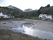
Head of Gillan Creek, near Carne
Carne lies on the south side of Gillan Creek at around 30 feet (9.1 m) above sea level.[1] Gillan Creek is a part of the Lower Fal and Helford Intertidal Site of Special Scientific Interest.
Carne lies within the Cornwall Area of Outstanding Natural Beauty (AONB).
References
- "DEFRA Magic Map Application". DEFRA. Retrieved 10 January 2016.
This article is issued from Wikipedia. The text is licensed under Creative Commons - Attribution - Sharealike. Additional terms may apply for the media files.