Cawsand
Cawsand (Cornish: Porthbugh; lit. Cow Cove)[1] and Kingsand (Cornish: Porthruw)[2] are twin villages in southeast Cornwall, England, United Kingdom.[3] The village is situated on the Rame Peninsula and is in the parish of Maker-with-Rame.
Cawsand
| |
|---|---|
 The Square, Cawsand | |
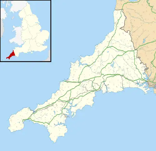
 Cawsand Location within Cornwall | |
| OS grid reference | SX434502 |
| Civil parish | |
| Unitary authority | |
| Ceremonial county | |
| Region | |
| Country | England |
| Sovereign state | United Kingdom |
| Post town | TORPOINT |
| Postcode district | PL10 |
| Dialling code | 01752 |
| Police | Devon and Cornwall |
| Fire | Cornwall |
| Ambulance | South Western |
| UK Parliament | |
Cawsand overlooks Plymouth Sound and adjoins Kingsand, formerly on the border of Devon and Cornwall (the border has since been moved and now is situated on the River Tamar). Cawsand has two public houses: the Cross Keys Inn on Armada Road, not trading and for sale in September 2022, and the Bay bar, overlooking Cawsand beach.
Cawsand is within Mount Edgcumbe Country Park. There are frequent bus services to the city of Plymouth which is three miles to the north across Plymouth Sound. There is also a ferry service in the summer (from Cawsand Bay to Plymouth Hoe) and a pilot gig club (Rame Gig Club).
The Rame Peninsula is considered part of the Forgotten Corner of Cornwall.
Geology
Cawsand Beach is sand and shingle with a network of rockpools and is found along The Bound.[4]
History
In 1596, local militia repelled an attack by Spanish forces and defences were built soon after.[5] Cawsand Fort (at 50°19′56″N 4°12′9″W) is sited just above the village. The fort is an 1860s Royal Commission on the Defence of the United Kingdom fort built on the site of a 1779 battery to mount about 10 guns to cover the western entrance to Plymouth Sound by the breakwater. Released by the Ministry of Defence in 1926, it remained derelict until it was converted into residential accommodation.[6]
Correspondence from 1801 to 1803 shows that Admiral Nelson had stayed in Cawsand[7] and it is rumoured that he had dined at the Ship Inn, which burned down in 2013 after several years of abandonment. The site has been cleared and is now being rebuilt by The Peninsula Trust which plans to turn the site into a cafe and affordable housing.[8]
Religion
St Andrew's Church was built as a chapel of ease in 1877–78.[9] It is a Grade II listed building.[10]
Originally built in 1793,[11] Cawsand also has a Congregational Church.
References
- "Cawsand". Map. 27 August 2019. Retrieved 1 October 2022.
- "Kingsand". Map. 27 August 2019. Retrieved 1 October 2022.
- Ordnance Survey: Landranger map sheet 201 Plymouth & Launceston ISBN 978-0-319-23146-3
- "Kingsand and Cawsand Beach Information - Cornwall Beach Guide". www.cornwallbeachguide.co.uk. Retrieved 23 November 2022.
- Carew, Richard (1953). The Survey of Cornwall. Melrose. p. 37.
- "Cawsand Fort". www.iwalkcornwall.co.uk. Retrieved 9 October 2023.
- A Selection from the Public and Private Correspondence or Vice-Admiral Lord Collingwood,G.L Newnham Collingwood, Volume 1, 2nd edition, pp. 111–114
- The Old Ship Inn, Cawsand, www.thepeninsulatrust.org.uk
- "St. Andrew's Chapel, Cawsand: Opening services". The Western Morning News. Plymouth. 29 May 1878. Retrieved 17 August 2019 – via British Newspaper Archive.
- Historic England. "CHURCH OF ST ANDREW, Maker-with-Rame (1329167)". National Heritage List for England. Retrieved 17 August 2019.
- Historic England, CONGREGATIONAL CHURCH, 1140673, in National Heritage List for England
- Twinning Committee for Cornwall, www.twinningcommitteeforcornwall.weebly.com
External links
![]() Media related to Cawsand at Wikimedia Commons
Media related to Cawsand at Wikimedia Commons
