Cela, Alcobaça
Cela is a freguesia (civil parish) in the municipality of Alcobaça, Portugal. The population in 2011 was 3,264,[1] in an area of 25.83 km2.[2] It received town status in 1999.
Cela | |
|---|---|
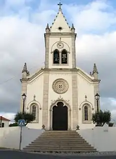 The Manueline style church of Santo André | |
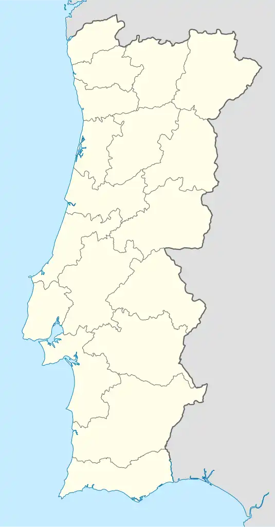 Cela Location in Portugal | |
| Coordinates: 39.537°N 9.038°W | |
| Country | |
| Region | Centro |
| Intermunic. comm. | Oeste |
| District | Leiria |
| Municipality | Alcobaça |
| Area | |
| • Total | 25.83 km2 (9.97 sq mi) |
| Population (2011) | |
| • Total | 3,264 |
| • Density | 130/km2 (330/sq mi) |
| Time zone | UTC±00:00 (WET) |
| • Summer (DST) | UTC+01:00 (WEST) |
Climate
| Climate data for Cela, 1981-2020, altitude: 2 m (6.6 ft) | |||||||||||||
|---|---|---|---|---|---|---|---|---|---|---|---|---|---|
| Month | Jan | Feb | Mar | Apr | May | Jun | Jul | Aug | Sep | Oct | Nov | Dec | Year |
| Average high °C (°F) | 14.5 (58.1) |
14.9 (58.8) |
17.1 (62.8) |
17.8 (64.0) |
19.5 (67.1) |
21.6 (70.9) |
23.1 (73.6) |
23.4 (74.1) |
22.7 (72.9) |
20.5 (68.9) |
17.2 (63.0) |
15.0 (59.0) |
18.9 (66.1) |
| Daily mean °C (°F) | 9.9 (49.8) |
10.6 (51.1) |
12.3 (54.1) |
13.5 (56.3) |
15.4 (59.7) |
17.5 (63.5) |
18.8 (65.8) |
18.9 (66.0) |
17.8 (64.0) |
15.9 (60.6) |
12.8 (55.0) |
10.9 (51.6) |
14.5 (58.1) |
| Average low °C (°F) | 5.3 (41.5) |
6.3 (43.3) |
7.5 (45.5) |
9.2 (48.6) |
11.3 (52.3) |
13.4 (56.1) |
14.5 (58.1) |
14.4 (57.9) |
12.9 (55.2) |
11.3 (52.3) |
8.4 (47.1) |
6.1 (43.0) |
10.1 (50.1) |
| Average precipitation mm (inches) | 78.7 (3.10) |
62.1 (2.44) |
42.4 (1.67) |
64.4 (2.54) |
52.1 (2.05) |
18.1 (0.71) |
9.1 (0.36) |
13.6 (0.54) |
32.0 (1.26) |
84.5 (3.33) |
99.4 (3.91) |
91.6 (3.61) |
648 (25.52) |
| Source: Portuguese Environment Agency[3] | |||||||||||||
References
- Instituto Nacional de Estatística
- "Áreas das freguesias, concelhos, distritos e país". Archived from the original on 2018-11-05. Retrieved 2018-11-05.
- "SNIRH > Dados de Base". snirh.apambiente.pt. Retrieved 25 June 2021.
Wikimedia Commons has media related to Cela, Alcobaça.
This article is issued from Wikipedia. The text is licensed under Creative Commons - Attribution - Sharealike. Additional terms may apply for the media files.