Centereach, New York
Centereach (/ˈsɛntəritʃ/) is a hamlet and census-designated place in Suffolk County, New York, United States. The population was 31,578 at the 2010 census.[2]
Centereach, New York | |
|---|---|
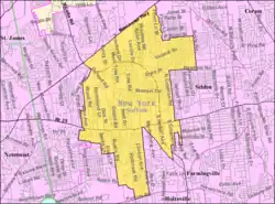
 U.S. Census map | |
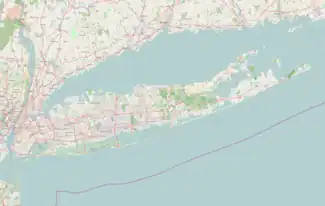
 Centereach, New York Location within the state of New York  Centereach, New York Centereach, New York (New York) | |
| Coordinates: 40°51′36.3″N 73°4′57.6″W | |
| Country | United States |
| State | New York |
| County | Suffolk |
| Town | Brookhaven |
| Area | |
| • Total | 8.92 sq mi (23.10 km2) |
| • Land | 8.92 sq mi (23.10 km2) |
| • Water | 0.00 sq mi (0.00 km2) |
| Elevation | 309 ft (94 m) |
| Population (2020) | |
| • Total | 30,980 |
| • Density | 3,473.87/sq mi (1,341.34/km2) |
| Time zone | UTC-5:00 (Eastern Time Zone) |
| • Summer (DST) | UTC-4:00 |
| ZIP Code | 11720 |
| Area code(s) | 631, 934 |
| FIPS code | 36-13376 |
| GNIS feature ID | 0946206 |
History
The hamlet of Centereach was first called West Middle Island, but primarily became known as New Village until the early 20th century. When it was discovered that another village shared the same name, the name was changed to Centereach in 1916. The name Centereach reflects the centrality of the hamlet's location on Long Island, literally meaning "center reached".[3]
Over the years Centereach has progressed from a small hamlet to a primarily suburban community. The population in 1940 was only 628, but the area had grown to nearly 20,000 residents by 1970.[3]
The two earliest suburban developments, which began in the early 1950s, were Dawn Estates and Eastwood Village.[4][5]
In 1998, the first single-point urban interchange in New York State was opened in Centereach, at Middle Country Road and Nicolls Road.[6]
Centereach, historically a working-class area, has experienced a construction boom in the past decade. As of 2009, the median home price was $335,000.[7] New construction in the Centereach area has resulted in an influx of residents with a higher median income.
Geography
According to the United States Census Bureau, the CDP has a total area of 8.7 square miles (22.6 km2), all land.[2]
New York State Route 25 (Middle Country Road) passes through the community and is the primary commercial thoroughfare.
Centereach borders East Setauket, Terryville, Selden, Farmingville, Holtsville, Holbrook, Lake Ronkonkoma, Lake Grove and Stony Brook on Long Island.
Demographics
| Census | Pop. | Note | %± |
|---|---|---|---|
| 1960 | 8,524 | — | |
| 1970 | 9,427 | 10.6% | |
| 1980 | 30,136 | 219.7% | |
| 1990 | 26,720 | −11.3% | |
| 2000 | 27,285 | 2.1% | |
| 2010 | 31,578 | 15.7% | |
| 2020 | 30,980 | −1.9% | |
| U.S. Decennial Census[8] | |||
As of the census[9] of 2000, there were 27,285 people, 8,176 households, and 6,998 families residing in the CDP. The population density was 3,429.4 inhabitants per square mile (1,324.1/km2). There were 8,329 housing units at an average density of 1,046.8 per square mile (404.2/km2). The racial makeup of the CDP was 75.36% White, Hispanic or Latino of any race were 14.08%, 4.98% African American, 0.18% Native American, 2.17% Asian, 0.01% Pacific Islander, 1.36% from other races, and 1.42% from two or more races.
There were 8,176 households, out of which 43.3% had children under the age of 18 living with them, 70.6% were married couples living together, 11.0% had a female householder with no husband present, and 14.4% were non-families. 10.3% of all households were made up of individuals, and 3.8% had someone living alone who was 65 years of age or older. The average household size was 3.27 and the average family size was 3.49.
In the CDP, the population was spread out, with 27.1% under the age of 18, 8.3% from 18 to 24, 32.1% from 25 to 44, 23.3% from 45 to 64, and 9.3% who were 65 years of age or older. The median age was 35 years. For every 100 females, there were 98.5 males. For every 100 females age 18 and over, there were 95.2 males.
The median income for a household in the CDP was $86,445, and the median income for a family was $92,178 as of a 2007 estimate[10]). Males had a median income of $49,167 versus $32,007 for females. The per capita income for the CDP was $23,197. About 3.7% of families and 5.6% of the population were below the poverty threshold, including 4.6% of those under age 18 and 14.2% of those age 65 or over.
Schools
- Middle Country Central School District
- Sachem School District
- Centereach High School
- Dawnwood Middle School
- Three Village Central School District - serves the Hamlet of South Setauket that shares a zip code with Centereach.
Notable people
- Don Heck, comic-book artist, co-creator of Iron Man (born New York City, lived in Centereach as adult)
- Suffocation
References
- "ArcGIS REST Services Directory". United States Census Bureau. Retrieved September 20, 2022.
- "Geographic Identifiers: 2010 Demographic Profile Data (G001): Centereach CDP, New York". U.S. Census Bureau, American Factfinder. Archived from the original on February 12, 2020. Retrieved December 24, 2012.
- "Newsday: Centereach, Legendary Gold Solidified a Family". Retrieved August 5, 2009.
- WLIW, David Overton, Brookhaven Town Historian on Centereach Archived 2011-07-27 at the Wayback Machine, October 7, 1993
- Vivien Kellerman (January 18, 1998). "If You're Thinking of Living In/Centereach, L.I.; A Backwater Blooms in a Half Century". The New York Times.
- Nicoll's Road @ NYCROADS.com
- "CNNMoney: Centereach". Retrieved August 5, 2009.
- "Census of Population and Housing". Census.gov. Retrieved June 4, 2016.
- "U.S. Census website". United States Census Bureau. Retrieved January 31, 2008.
- American Fact Finder