Shire of Central Goldfields
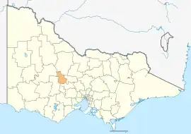
Central Goldfields Shire is a local government area in Victoria, Australia, located in the central part of the state. It covers an area of 1,533 square kilometres (592 sq mi) and, in August 2021 had a population of 13,483.[3]
| Shire of Central Goldfields Victoria | |||||||||||||||
|---|---|---|---|---|---|---|---|---|---|---|---|---|---|---|---|
 Location in Victoria | |||||||||||||||
| Population | 13,483 (2021)[1] | ||||||||||||||
| • Density | 8.795/km2 (22.779/sq mi) | ||||||||||||||
| Established | 1995 | ||||||||||||||
| Gazetted | 19 January 1995[2] | ||||||||||||||
| Area | 1,533 km2 (591.9 sq mi)[3] | ||||||||||||||
| Mayor | Vacant | ||||||||||||||
| Council seat | Maryborough | ||||||||||||||
| Region | Loddon Mallee | ||||||||||||||
| State electorate(s) | Ripon | ||||||||||||||
| Federal division(s) | Mallee | ||||||||||||||
| Website | Shire of Central Goldfields | ||||||||||||||
| |||||||||||||||
It includes the towns of Bealiba, Carisbrook, Dunolly, Maryborough and Talbot. It was formed in 1995 from the amalgamation of the City of Maryborough, most of the Shire of Tullaroop, and parts of the Shire of Bet Bet and Shire of Talbot and Clunes.[2]
The Shire is governed and administered by the Central Goldfields Shire Council; its seat of local government and administrative centre is located at the council headquarters in Maryborough. It also has a service centre located in Talbot. The Shire is named after the region having historically been a major goldfields region in central Victoria.
Council
Current composition
The council is composed of four wards and seven councillors, with four councillors elected to represent the Maryborough Ward and one councillor per remaining ward elected to represent each of the other wards.[4]
In August 2017 the elected council members of the Central Goldfields Shire were removed from office by the Victorian Government. This removal was facilitated due to financial mismanagement. Three administrators were then appointed by Natalie Hutchins the then Local Government Minister to replace the council until the 2020 local government elections. The three administrators are: Noel Harvey OAM, The Hon Hugh Delahunty, and Karen Douglas.
Councillors elected at the 2020 election are:[5]
| Ward | Councillor | Notes | |
|---|---|---|---|
| Flynn | Liesbeth Long | ||
| Maryborough | Gerard Murphy | ||
| Grace La Vella | |||
| Wayne Sproull | |||
| Geoff Lovett | |||
| Paddys Ranges | Chris Meddows-Taylor | ||
| Tullaroop | Anna De Villiers | ||
Administration and governance
The council meets in the council chambers at the council headquarters in the Maryborough Municipal Offices, which is also the location of the council's administrative activities. It also provides customer services at both its administrative centre in Maryborough, and its service centre in Talbot.
Townships and localities
The 2021 census, the shire had a population of 13,483 up from 12,995 in the 2016 census[6]
| Population | ||
|---|---|---|
| Locality | 2016 | 2021 |
| Adelaide Lead | 81 | 85 |
| Alma | 201 | 195 |
| Amherst | 65 | 63 |
| Archdale^ | 21 | 23 |
| Archdale Junction^ | 6 | 12 |
| Bealiba^ | 206 | 213 |
| Bet Bet | 129 | 135 |
| Betley | 102 | 101 |
| Bowenvale | 181 | 209 |
| Bromley | 56 | 46 |
| Caralulup | 3 | 3 |
| Population | ||
|---|---|---|
| Locality | 2016 | 2021 |
| Carisbrook^ | 1,115 | 1,192 |
| Cotswold | 12 | 20 |
| Craigie | 57 | 62 |
| Daisy Hill | 385 | 398 |
| Dunach | 58 | 83 |
| Dunluce | 36 | 36 |
| Dunolly^ | 893 | 899 |
| Eddington^ | 96 | 113 |
| Emu^ | 32 | 37 |
| Flagstaff | 87 | 97 |
| Population | ||
|---|---|---|
| Locality | 2016 | 2021 |
| Goldsborough^ | 36 | 37 |
| Havelock | 74 | 83 |
| Inkerman^ | * | # |
| Joyces Creek^ | 12 | 20 |
| Majorca | 211 | 198 |
| Maryborough | 7,921 | 8,160 |
| Moliagul^ | 88 | 80 |
| Moolort^ | 32 | 44 |
| Moonlight Flat | 77 | 85 |
| Mount Glasgow | 85 | 92 |
^ - Territory divided with another LGA
* - Not noted in 2016 Census
# - Not noted in 2021 Census
See also
References
- Australian Bureau of Statistics (28 June 2022). "2021 Community Profiles: Central Goldfields (Local Government Area)". 2021 Census of Population and Housing. Retrieved 8 May 2023.
- Victoria Government Gazette – Online Archive (1837–1997). "S2 of 1995: Order estg (Part 4) the Shire of Central Goldfields". State Library of Victoria. State Government of Victoria (published 19 January 1995). pp. 2–3. Retrieved 10 January 2014.
- "3218.0 – Regional Population Growth, Australia, 2017-18: Population Estimates by Local Government Area (ASGS 2018), 2017 to 2018". Australian Bureau of Statistics. Australian Bureau of Statistics. 27 March 2019. Retrieved 25 October 2019. Estimated resident population, 30 June 2018.
- Local Government in Victoria. "Central Goldfields Shire Council". Department of Transport, Planning and Local Infrastructure. State Government of Victoria. Retrieved 10 January 2014.
- "Central Goldfields Shire Council election results 2020". www.vec.vic.gov.au. Retrieved 8 November 2020.
- "Census | Australian Bureau of Statistics". www.abs.gov.au. 11 January 2023.
External links
- Central Goldfields Shire Council official website
- Metlink local public transport map
- Link to Land Victoria interactive maps
Localities in the Shire of Central Goldfields | ||
|---|---|---|
| City | 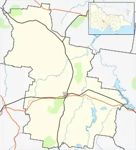 | |
| Town | ||
| Locality |
| |
^ - Territory divided with another LGA | ||