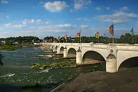
Centre-Val de Loire
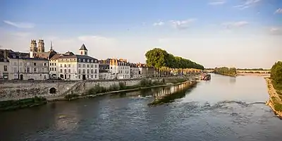
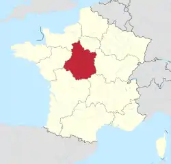
Centre-Val de Loire (/ˌvæl də ˈlwɑːr/, /ˌvɑːl-/, French pronunciation: [sɑ̃tʁə val də lwaʁ],[Notes 1] lit. 'Centre-Loire Valley') or Centre Region (French: région Centre, [ʁeʒjɔ̃ sɑ̃tʁ]), as it was known until 2015, is one of the eighteen administrative regions of France. It straddles the middle Loire Valley in the interior of the country, with a population of 2,572,853 as of 2018. Its prefecture is Orléans, and its largest city is Tours.
Centre-Val de Loire
Centre e Vau de Léger (Occitan) | |
|---|---|
 | |
 Flag  Coat of arms | |
 | |
| Country | |
| Prefecture | Orléans |
| Departments | |
| Government | |
| • President of the Regional Council | François Bonneau (PS) |
| Area | |
| • Total | 39,151 km2 (15,116 sq mi) |
| • Rank | 7th |
| Population | |
| • Total | 2,574,863 |
| • Density | 66/km2 (170/sq mi) |
| Time zone | UTC+01:00 (CET) |
| • Summer (DST) | UTC+02:00 (CEST) |
| ISO 3166 code | FR-CVL |
| GDP (2012)[2] | Ranked 9th |
| Total | €67.1 billion (US$86.3 bn) |
| Per capita | €26,126 (US$33,603) |
| NUTS Region | FR2 |
| Largest city | Tours |
| Website | www |
Naming and etymology

Like many contemporary regions of France, the region of Centre-Val de Loire was created from parts of historical provinces: Touraine, Orléanais and Berry. First, the name Centre was chosen by the government purely on the basis of geography, in reference to its location in northwest-central France (the central part of the original French language area).
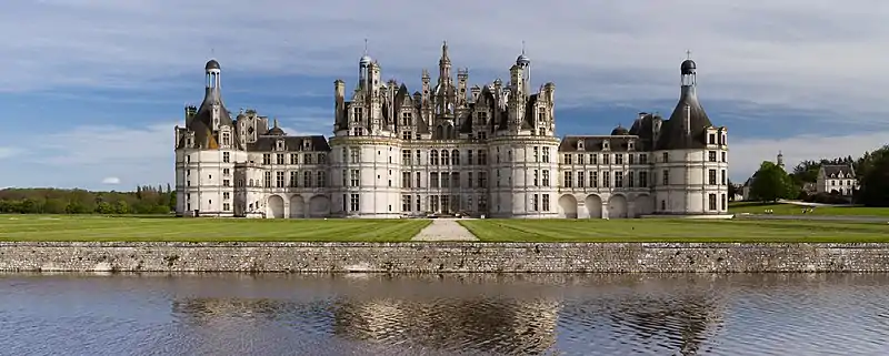
However, Centre is not situated in the geographical centre of France (except the Cher department); the name was criticised as being too dull and nondescript. Proposed names for the region included Val de Loire after the Loire Valley (the main feature of the region) or Cœur de Loire (Heart of Loire). On 17 January 2015, as part of the reorganisation of French regions, the region's official name was changed to Centre-Val de Loire.[3] Val de Loire is associated with positive images of the Loire Valley, such as the châteaux, the gentle and refined lifestyle, wine, as well as the mild and temperate climate, all of which attract many tourists to the region. A new logo was also created.
Geography
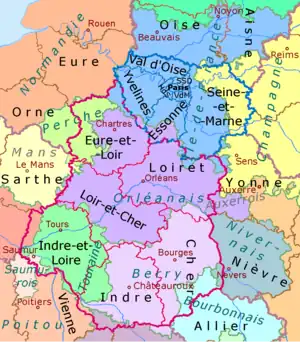
Bordering six other regions, Centre-Val-de-Loire borders the most of all eighteen regions in France. The bordering regions are Normandy on the northwest, Île-de-France on the northeast, Bourgogne-Franche-Comté on the east, Auvergne-Rhône-Alpes on the southeast, Nouvelle-Aquitaine on the southwest and Pays de la Loire on the west.
Departments
Centre-Val de Loire comprises six departments: Cher, Eure-et-Loir, Indre, Indre-et-Loire, Loir-et-Cher and Loiret.
Largest cities
- Tours with 136,463 inhabitants (2018)
- Orléans with 116,238 inhabitants (2018)
- Bourges with 64,668 inhabitants (2018)
- Blois with 45,871 inhabitants (2018)
- Châteauroux with 43,442 inhabitants (2018)
- Chartres with 38,426 inhabitants (2018)
- Joué-lès-Tours with 38,250 inhabitants (2018), Tours Métropole Val de Loire
- Dreux with 30,664 inhabitants (2018)
- Vierzon with 25,725 inhabitants (2018)
- Olivet with 22,168 inhabitants (2018), Orléans Métropole
Economy
The gross domestic product (GDP) of the region was 72.4 billion euros in 2018, accounting for 3.1% of French economic output. GDP per capita adjusted for purchasing power was 25,200 euros or 84% of the EU27 average in the same year. The GDP per employee was 99% of the EU average.[4]
An economic development agency, called Centréco, was created in 1994 by the Regional Council of Centre to promote the inflow of investments and the establishment setting-up of new businesses French and foreign companies in the Centre region. This ensures a mission of economic promotion, international support to regional companies and enhancement promotion of regional agrofood products via a regional signature, du Centre.
See also
Notes
- In isolation, Centre is pronounced [sɑ̃tʁ].
References
- "Téléchargement du fichier d'ensemble des populations légales en 2020". The National Institute of Statistics and Economic Studies. 29 December 2022.
- INSEE. "Produits intérieurs bruts régionaux et valeurs ajoutées régionales de 1990 à 2012". Retrieved 2014-03-04.
- "Journal officiel of 17 January 2015". Légifrance (in French). 2015-01-17. Retrieved 2015-03-10.
- "Regional GDP per capita ranged from 30% to 263% of the EU average in 2018". Eurostat. Archived from the original on 2020-04-17.
External links
![]() Media related to Centre-Val de Loire at Wikimedia Commons
Media related to Centre-Val de Loire at Wikimedia Commons
- Official website
- Centre : on the road of the châteaux - Official French website (in English)
- Centre at Curlie
- Website of the agency for promotion and economic development of the Centre / Loire Valley region
- About-France - overview of the region and main attractions
- Experience Loire - information on the region and its departments
