Champdeniers
Champdeniers (French pronunciation: [ʃɑ̃dənje]; before 2018: Champdeniers-Saint-Denis)[3] is a commune in the Deux-Sèvres department in the Nouvelle-Aquitaine region in western France.
Champdeniers | |
|---|---|
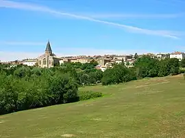 A general view of Champdeniers | |
 Coat of arms | |
Location of Champdeniers | |
 Champdeniers  Champdeniers | |
| Coordinates: 46°29′06″N 0°24′14″W | |
| Country | France |
| Region | Nouvelle-Aquitaine |
| Department | Deux-Sèvres |
| Arrondissement | Parthenay |
| Canton | Autize-Égray |
| Intercommunality | Val de Gâtine |
| Government | |
| • Mayor (2020–2026) | Alain Capelle[1] |
| Area 1 | 21.81 km2 (8.42 sq mi) |
| Population | 1,753 |
| • Density | 80/km2 (210/sq mi) |
| Time zone | UTC+01:00 (CET) |
| • Summer (DST) | UTC+02:00 (CEST) |
| INSEE/Postal code | 79066 /79220 |
| Elevation | 67–171 m (220–561 ft) (avg. 120 m or 390 ft) |
| 1 French Land Register data, which excludes lakes, ponds, glaciers > 1 km2 (0.386 sq mi or 247 acres) and river estuaries. | |
References
- "Répertoire national des élus: les maires". data.gouv.fr, Plateforme ouverte des données publiques françaises (in French). 9 August 2021.
- "Populations légales 2020". The National Institute of Statistics and Economic Studies. 29 December 2022.
- Décret n° 2018-956 5 November 2018 (in French)
Wikimedia Commons has media related to Champdeniers.
This article is issued from Wikipedia. The text is licensed under Creative Commons - Attribution - Sharealike. Additional terms may apply for the media files.