Charleston Cemeteries Historic District
The Charleston Cemeteries Historic District encompasses a cluster of 23 cemeteries north of downtown Charleston, South Carolina. Laid out on either side of Huguenin Street in the northern part of peninsular Charleston, they were laid out between 1849 and 1956, and represented a concentrated diversity in funerary art and cemetery landscape design practices. The oldest cemetery is Magnolia Cemetery, laid out in 1849 in the then-fashionable rural cemetery style.[2]
Charleston Cemeteries Historic District | |
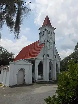 Bethany Cemetery chapel | |
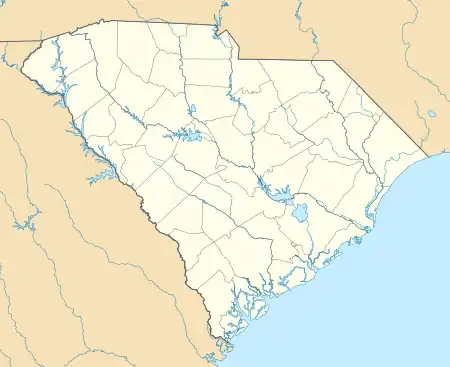  | |
| Location | Huguenin Ave., roughly bounded by Algonquin Rd., CSXRR, N. Romney & Meeting Sts., Charleston, South Carolina |
|---|---|
| Coordinates | 32°49′N 79°57′W |
| Built | 1849 |
| NRHP reference No. | 100001367[1] |
| Added to NRHP | July 24, 2017 |
The district was listed on the National Register of Historic Places in 2017.[1]
See also
References
- "National Register Information System". National Register of Historic Places. National Park Service. July 9, 2010.
- "Historic Preservation News and Notes" (PDF). South Carolina SHPO. Archived from the original (PDF) on 2017-11-07. Retrieved 2017-11-06.
Further reading
- Karpiel, Frank (2013). Charleston's Historic Cemeteries. Charleston, SC: Arcadia Press (Images of America). ISBN 978-1467110235. OCLC 838416953.
- Beney, Peter (2005) [1993]. The Majesty of Charleston (2nd ed.). Gretna, LA: Pelican Publishing. ISBN 978-1589802704. OCLC 56617323.
| Topics |  | |
|---|---|---|
| Lists by county |
| |
| Lists by city | ||
| Other lists | ||
This article is issued from Wikipedia. The text is licensed under Creative Commons - Attribution - Sharealike. Additional terms may apply for the media files.