Charlevoix-Est Regional County Municipality
Charlevoix-Est is a regional county municipality in the Capitale-Nationale region of Quebec, Canada. The seat is Clermont.
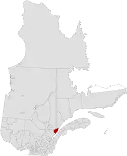
Charlevoix-Est | |
|---|---|
 | |
| Coordinates: 47°44′N 69°59′W[1] | |
| Country | |
| Province | |
| Region | Capitale-Nationale |
| Effective | January 1, 1982 |
| County seat | Clermont |
| Government | |
| • Type | Prefecture |
| • Prefect | Bernard Maltais |
| Area | |
| • Total | 2,957.40 km2 (1,141.86 sq mi) |
| • Land | 2,307.23 km2 (890.83 sq mi) |
| Population (2016)[3] | |
| • Total | 15,509 |
| • Density | 6.7/km2 (17/sq mi) |
| • Change 2011-2016 | |
| • Dwellings | 8,707 |
| Time zone | UTC−5 (EST) |
| • Summer (DST) | UTC−4 (EDT) |
| Area code(s) | 418 and 581 |
| Website | www |
Subdivisions
There are 9 subdivisions within the RCM:[2]
|
|
|
Demographics
Population
Canada census – Charlevoix-Est community profile
| 2021 | 2016 | 2011 | |
|---|---|---|---|
| Population | 15,409 (-0.6% from 2016) | 15,509 (-4.5% from 2011) | 16,240 (-0.8% from 2006) |
| Land area | 2,288.97 km2 (883.78 sq mi) | 2,307.23 km2 (890.83 sq mi) | 2,305.84 km2 (890.29 sq mi) |
| Population density | 6.7/km2 (17/sq mi) | 6.7/km2 (17/sq mi) | 7.0/km2 (18/sq mi) |
| Median age | 54.4 (M: 53.6, F: 55.2) | 51.7 (M: 51.0, F: 52.5) | 48.9 (M: 48.2, F: 49.7) |
| Private dwellings | 8,664 (total) 7,138 (occupied) | 8,707 (total) | 8,606 (total) |
| Median household income | $64,500 | $55,727 | $50,043 |
|
| ||||||||||||||||||||||||
| [9][3] | |||||||||||||||||||||||||
Language
| Canada Census Mother Tongue - Charlevoix-Est Regional County Municipality, Quebec[9][3] | ||||||||||||||||||
|---|---|---|---|---|---|---|---|---|---|---|---|---|---|---|---|---|---|---|
| Census | Total | French |
English |
French & English |
Other | |||||||||||||
| Year | Responses | Count | Trend | Pop % | Count | Trend | Pop % | Count | Trend | Pop % | Count | Trend | Pop % | |||||
2016 |
15,295 |
15,105 | 98.76% | 75 | 0.49% | 30 | 0.20% | 85 | 0.56% | |||||||||
2011 |
16,025 |
15,860 | 98.97% | 85 | 0.53% | 35 | 0.22% | 45 | 0.28% | |||||||||
2006 |
16,170 |
15,950 | 98.64% | 55 | 0.34% | 10 | 0.06% | 155 | 0.96% | |||||||||
2001 |
16,380 |
16,250 | 99.21% | 85 | 0.52% | 35 | 0.21% | 10 | 0.06% | |||||||||
1996 |
16,750 |
16,540 | n/a | 98.75% | 125 | n/a | 0.75% | 45 | n/a | 0.27% | 40 | n/a | 0.24% | |||||
Transportation
References
- "Reference number 141110 in Banque de noms de lieux du Québec". toponymie.gouv.qc.ca (in French). Commission de toponymie du Québec.
- "Geographic code 150 in the official Répertoire des municipalités". www.mamh.gouv.qc.ca (in French). Ministère des Affaires municipales et de l'Habitation.
- "Census Profile, 2016 Census: Charlevoix-Est, Municipalité régionale de comté [Census division], Quebec". Statistics Canada. Retrieved December 10, 2019.
- "2021 Community Profiles". 2021 Canadian Census. Statistics Canada. February 4, 2022. Retrieved 2023-10-19.
- "2016 Community Profiles". 2016 Canadian Census. Statistics Canada. August 12, 2021. Retrieved 2019-12-10.
- "2011 Community Profiles". 2011 Canadian Census. Statistics Canada. March 21, 2019. Retrieved 2014-03-02.
- "2006 Community Profiles". 2006 Canadian Census. Statistics Canada. August 20, 2019.
- "2001 Community Profiles". 2001 Canadian Census. Statistics Canada. July 18, 2021.
- Statistics Canada: 1996, 2001, 2006, 2011 census
- Official Transport Quebec Road Map
External links
- official website (in French)
Adjacent Counties & Equivalent Territories | |
|---|---|
| Regional county municipalities and equivalent territories | |
|---|---|
| Municipalities | |
This article is issued from Wikipedia. The text is licensed under Creative Commons - Attribution - Sharealike. Additional terms may apply for the media files.