Chathenkary
Chathenkary is a village in the Peringara gram panchayat in the Thiruvalla taluk of the Pathanamthitta district, Kerala.[1]
Chathenkary | |
|---|---|
Village | |
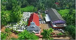 Aerial view of the St. Paul's Marthoma Church | |
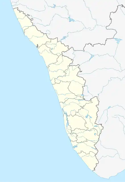 Chathenkary Location in Kerala, India | |
| Coordinates: 9°22′0″N 76°32′0″E | |
| Country | |
| State | Kerala |
| District | Pathanamthitta |
| Highest elevation | 1.5 m (4.9 ft) |
| Lowest elevation | −1 m (−3 ft) |
| Population (2001) | |
| • Total | 15,089 |
| Languages | |
| • Official | Malayalam, English |
| Time zone | UTC+5:30 (IST) |
| PIN | 689112 |
| Vehicle registration | KL-27 |
| Nearest city | Thiruvalla |
| Lok Sabha constituency | Pathanamthitta |
| Vidhan Sabha constituency | Thiruvalla |
Chathenkary is part of the wider Kuttanad geographical area. Chathenkary is located 1.7 kilometres west of Peringara and 6 km east of Thiruvalla.
Worship centres
- St Paul's Mar Thoma Church[2]
- Chathenkary Sri Bhagavathi Temple
- St. Mathew's marthoma church
- St Joseph Chapel Chathenkary
- St. Mary's Malankara Catholic Church
- Sharon Fellowship church
- Chathenkary Sree Ardhanareeshwara Temple
Schools
- Govt LP School
- Govt New LP School
- SNDP High School, Chathenkary
Politics
The Indian National Congress, the CPIM, the] and are the major political parties in this area.
Hospitals
- Manak Hospital, Chathenkary mukku
- Primary Health Centre, Chathenkary
Notable people
Transport
Bus
Private bus available from Chathenkary junction to other parts of Kerala.
Railway
Thiruvalla railway station is near station to Chathenkary.
Air
Cochin International Airport Nedumbassery is 115 km away from Chathenkary.
This article is issued from Wikipedia. The text is licensed under Creative Commons - Attribution - Sharealike. Additional terms may apply for the media files.