Chili, New York
Chili (/ˈtʃaɪlaɪ/ CHY-ly)[3] is a town in Monroe County, New York, United States. The population was 29,123 at the 2020 census.[4] It is a suburb of the city of Rochester.
Chili | |
|---|---|
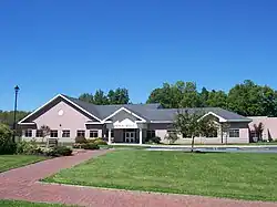 Chili town hall | |
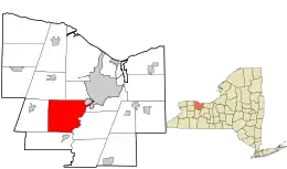 Location in Monroe County and the state of New York. | |
.svg.png.webp) Location of New York in the United States | |
| Coordinates: 43°06′14″N 77°45′10″W | |
| Country | United States |
| State | New York |
| County | Monroe |
| Established | February 22, 1822[1] |
| Government | |
| • Type | Council Government |
| • Town Supervisor | David Dunning (R) First Elected 2007
|
| Area | |
| • Total | 39.87 sq mi (103.25 km2) |
| • Land | 39.50 sq mi (102.30 km2) |
| • Water | 0.37 sq mi (0.96 km2) |
| Elevation | 556 ft (169 m) |
| Population (2020) | |
| • Total | 29,123 |
| • Density | 729.00/sq mi (281.47/km2) |
| Time zone | UTC-5 (EST) |
| • Summer (DST) | UTC-4 (EDT) |
| ZIP code | 14624 14514 (North Chili) |
| Area code | 585 |
| FIPS code | 36-055-15462 |
| Website | http://www.townofchili.org/ |
The Town of Chili was established in 1822 from part of the Town of Riga. North Chili was a stop on the Underground Railroad. Black Creek Park is one of many parks in Chili where visitors can make use of nature trails that run along the creek.
History
The Chili area was once the hunting ground of the Seneca Indians. The first white settler was Captain Joseph Morgan who purchased land from Peter Sheffer of neighboring Wheatland.
The area of Chili became part of the newly formed Northampton. With the formation of Monroe County the area became part of the Town of Riga before splitting off into its own Town of Chili on February 22, 1822.
Chili was named after the country of Chile which was striving for independence at the time. Some suggest that the town was named after the Chiliasts[5] religion embraced by some of the early settlers of South Chili. This is still controversial as there is no evidence to either side.
The local government includes Town Supervisor David Dunning (R) First Elected 2007; and Town Council Mark Decory (R); James Valerio (R); Michael S. Slattery (R); and Mary C. Sperr (R). The appointed Deputy Town Supervisor is Michael S. Slattery. The Chili Mills Conservation Area was listed on the National Register of Historic Places in 1975.[6]
Geography
According to the United States Census Bureau, the town has a total area of 39.9 square miles (103 km2), of which 39.8 square miles (103 km2) is land and 0.2 square miles (0.52 km2) (0.48%) is water.
Demographics
| Census | Pop. | Note | %± |
|---|---|---|---|
| 1830 | 2,010 | — | |
| 1840 | 2,174 | 8.2% | |
| 1850 | 2,247 | 3.4% | |
| 1860 | 2,205 | −1.9% | |
| 1870 | 2,367 | 7.3% | |
| 1880 | 2,274 | −3.9% | |
| 1890 | 2,109 | −7.3% | |
| 1900 | 2,099 | −0.5% | |
| 1910 | 2,071 | −1.3% | |
| 1920 | 1,780 | −14.1% | |
| 1930 | 2,493 | 40.1% | |
| 1940 | 3,392 | 36.1% | |
| 1950 | 5,283 | 55.7% | |
| 1960 | 11,237 | 112.7% | |
| 1970 | 19,609 | 74.5% | |
| 1980 | 23,676 | 20.7% | |
| 1990 | 25,178 | 6.3% | |
| 2000 | 27,638 | 9.8% | |
| 2010 | 28,625 | 3.6% | |
| 2020 | 29,123 | 1.7% | |
| U.S. Decennial Census[7][4] | |||
As of the census[8] of 2000, there were 27,638 people, 10,159 households, and 7,558 families residing in the town. The population density was 695.4 inhabitants per square mile (268.5/km2). There were 10,466 housing units at an average density of 263.3 per square mile (101.7/km2). The racial makeup of the town was 91.14% White, 5.71% African American, 0.24% Native American, 1.12% Asian, 0.02% Pacific Islander, 0.52% from other races, and 1.25% from two or more races. Hispanic or Latino of any race were 1.65% of the population.
There were 10,159 households, out of which 34.7% had children under the age of 18 living with them, 61.7% were married couples living together, 9.1% had a female householder with no husband present, and 25.6% were non-families. 20.2% of all households were made up of individuals, and 7.5% had someone living alone who was 65 years of age or older. The average household size was 2.67 and the average family size was 3.09.
In the town, the population was spread out, with 25.6% under the age of 18, 8.6% from 18 to 24, 29.4% from 25 to 44, 24.2% from 45 to 64, and 12.1% who were 65 years of age or older. The median age was 37 years. For every 100 females, there were 94.9 males. For every 100 females age 18 and over, there were 91.4 males.
The median income for a household in the town was $55,097, and the median income for a family was $61,481. Males had a median income of $45,156 versus $29,903 for females. The per capita income for the town was $23,887. About 2.0% of families and 3.6% of the population were below the poverty line, including 3.7% of those under age 18 and 2.5% of those age 65 or over.
Education
Chili is served by the Churchville-Chili Central School District, Gates Chili Central School District, and Wheatland–Chili Central School District.[9]
Government
The town is governed by a town board consisting of a supervisor and four board members, all elected by registered town voters.
| Name | Tenure | Name | Tenure | |
|---|---|---|---|---|
| Joseph Sibley | 1822-1823 | Thomas B. Steckel | 1952-1959 | |
| Joshua Howell | 1824-1825 | George K. Lusk | 1960-1965 | |
| Alfred Scofield | 1826-1828 | Samuel S. Kent | 1966-1971 | |
| Isaac Lacey | 1829 1840 | James J. Powers | 1972-1985 | |
| Benjamin Bowen | 1830 | Lorraine Anderson | 1986-1987 | |
| William Pixley | 1831-1832 1836-1837 1852-1853 | John Hannah | 1988-1989 | |
| George Brown | 1833-1834 | Donald Ramsey | 1990-1991 | |
| Moses Sperry | 1835 1838-1839 1844 1854 | Jerome P. Brixner | 1992-1993 | |
| John T. Lacey | 1841 1843 1845-1846 | William C. Kelly | 1994-1999 | |
| Isaac Burritt | 1842 | Stephen W. Hendershott | 2000-2003 | |
| William P. Hill | 1847-1848 1861-1864 1867 1878 (part year) 1880-1881 | Tracy L. Logel | 2004-2007 | |
| Franklin Cate | 1849-1851 | David J. Dunning | 2008–present | |
| David Starkey | 1855-1858 | |||
| Edward J. Reed | 1859-1860 | |||
| A. S. Litle | 1865 | |||
| Albert H. King | 1866 1871 | |||
| William Voke | 1868-1870 | |||
| Frederick Fellows | 1872-1877 | |||
| William Fellows | 1878 (part year) | |||
| Edwin A. Loder | 1879 | |||
| Benjamin Fellows | 1882-1884 | |||
| Byron D. Beal | 1885-1886 | |||
| Lewis B. Carpenter | 1887-1890 1896-1898 | |||
| Myron Sperry | 1891 | |||
| John B. Johnston | 1892-1895 | |||
| Arthur A. Sickles | 1899-1901 | |||
| Cornelius A. Nichols | 1902-1907 | |||
| Charles G. Voke | 1908-1915 | |||
| Warren R. Henderson | 1916-1929 | |||
| W. H. Wickins | 1930-1935 | |||
| Gage M. Miller | 1936-1949 | |||
| Oakley Decker | 1950-1951 |
Communities and locations
- Chili Center – The centre of town government and the most urbanized portion of the town.
- Genesee River – Part of the east border of the town.
- North Chili – A hamlet in the northwest part of the town and home to Roberts Wesleyan College.
- South Chili – A rural area in Chili running along the New York State Thruway. The first business was located here called the Checker Tavern
- West Chili – A small community located just north of Black Creek Park. Originally called Buckbee's Corners.
- East Chili - A small community in the eastern part of the town. This does not exist in present day.
- Clifton- A small rural hamlet in the southern part of the town. Originally called Hardscrabble, it produced a world award winning type of flour.
Places of local interest
Public library
The Chili Public Library is the public library serving Chili, New York. It is currently located in the recently erected town government center at 3333 Chili Avenue. Previously, it occupied the old town government complex further east on Chili Avenue.
Roberts Wesleyan University
Roberts is a private, Christian, liberal arts college located in North Chili. The school enrolls approximately 2,000 students. The school hosts various community events on its facilities, including soccer games, swimming lessons, dance recitals, fireworks, concerts, drama productions and many other events.
In 2022 Roberts was declared a university rather than a college.
American Legion
Occupying the former Grange Hall, Chili American Legion Family Post 1830 at 450 Chili-Scottsville Rd., Scottsville, New York
Black Creek Park
While Black Creek Park is still a relatively undeveloped park, its 1,505-acres has many unique features to offer. The park provides opportunities for hiking, soccer, fishing, horseback riding, sledding, and cross country skiing. It also features a playground located near the Pathfinder Shelter. The park offers five hiking trails, all of which are excellent settings to view nature and animals. If you are going hiking, it is suggested that you print off a map. Each year emergency services are called for a lost or overdue hiker.
Hubbard Park
Town of Chili Community Center
Chili Disk Golf Course
Chili Disk Golf Course at Widener Park, 400 Chili Scottsville Road
Morgan's Crossing Golf Course
Morgan's Crossing Golf Course at, 760 Scottsville-Chili Road
Notable people
- Homer G. Balcom, structural engineer of the Empire State Building, was born in Chili in 1870.
References
- Hanford, Franklin (1911). On the origin of the names of places in Monroe County, New York (PDF). Scottsville, New York: Isaac Van Hooser. p. 7. OCLC 866011722. Retrieved December 2, 2021.
- "2016 U.S. Gazetteer Files". United States Census Bureau. Retrieved July 5, 2017.
- Chili Town Board Meeting 12-14-2022, retrieved January 19, 2023
- "2020 Census Data". United States Census Bureau. Retrieved August 5, 2023.
- "Historical Digest of Early Chili". Archived from the original on May 9, 2008. Retrieved July 8, 2008.
- "National Register Information System". National Register of Historic Places. National Park Service. July 9, 2010.
- "Census of Population and Housing". Census.gov. Retrieved June 4, 2015.
- "U.S. Census website". United States Census Bureau. Retrieved January 31, 2008.
- "School Districts Serving Chili, NY". Niche. Retrieved March 5, 2023.
External links
Municipalities and communities of Monroe County, New York, United States | ||
|---|---|---|
| City | 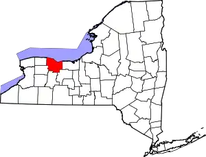 Map of New York highlighting Monroe County | |
| Towns | ||
| Villages | ||
| CDPs | ||
| Other hamlets | ||
| Footnotes | ‡This populated place also has portions in an adjacent county or counties | |