Chilkur, Suryapet district
Chilkur (Chilkuru) is a census town in Suryapet district of the Indian state of Telangana.It is 50 km away from district headquarters Suryapet and Lies between Kodad and Huzurnagar.[1].It is the headquarters of Chilkur mandal of Kodad revenue division.
Chilkur | |
|---|---|
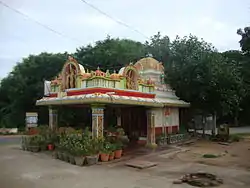
 Kotta Chilkur Anjaneya Temple | |
| Nickname: Chilukur | |
 Chilkur Location in Telangana, India  Chilkur Chilkur (India) | |
| Coordinates: 16°57′40″N 79°54′45″E | |
| Country | India |
| State | Telangana |
| District | Suryapet |
| Government | |
| • Type | Gram Panchayat |
| • Body | Chilkur Gram Panchayat |
| • Sarpanch | Puttapaka Srinu (Communist Party of India) |
| • MLA | B. Mallaiah yadhav |
| Population (2011) | |
| • Total | 18,952 |
| Languages | |
| • Official | Telugu |
| Time zone | UTC+5:30 (IST) |
| PIN | 508206 |
| Vehicle registration | TS-29 |
| Lok Sabha constituency | Nalgonda |
| Vidhan Sabha constituency | Kodad |
| Website | https://manachilkur.blogspot.in/ |
Climate
It is too Hot in summer. Chilkur summer highest day temperature is in between 35 °C to 48 °C . Average temperatures of January is 24 °C, February is 26 °C, March is 29 °C, April is 33 °C, May is 36 °C.[1]
Demographics
According to Census of India, 2011, population of Chilkur is 18,952 of which 9,578 are male and 9,374 are female. The literacy rate is 85.7%. Sex ratio is 986 females to 1000 males. Child sex ratio is 951 girls to 1000 boys.[1]
Governance
Politics
Chilkur is Mandal Headquarters falls under Kodad (Assembly constituency) of Telangana Legislative Assembly. Sri.Bollam Mallaiah Yadav is the present MLA of the constituency from TRS.[2][3]
History
Chilkur had some best pages in History.Chalukyas, Kakatiyas and Nizam dynasties ruled the region.[4]
References
- 2808_PART_B_DCHB_NALGONDA (PDF). CENSUS INDIA. 2011.
- Election Commission of India. p. 14,29. Retrieved 11 October 2014 (PDF).
- "Telangana State Portal Members of Legislative Assembly". www.telangana.gov.in. Retrieved 27 June 2016.
- "Chilkur Suryapet". Welcome to ManaChilkur.