Chhoti Sadri
Chhoti Sadri is a town and a municipality in Pratapgarh district in the state of Rajasthan, India.[1]
Chhoti Sadri | |
|---|---|
city | |
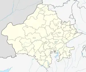
 Chhoti Sadri Location in Rajasthan, India  Chhoti Sadri Chhoti Sadri (India) | |
| Coordinates: 24.38°N 74.70°E | |
| Country | |
| State | Rajasthan |
| District | Pratapgarh |
| Elevation | 485 m (1,591 ft) |
| Population (2011) | |
| • Total | 18,360 |
| Languages | |
| • Official | Hindi |
| Time zone | UTC+5:30 (IST) |
| Telephone code | +91-1473 |
Chhoti sadri town is situated near Rajasthan and Madhya Pradesh border and well connected with Pratapgarh and Chittaurgarh by national highway 113. Nearest railway station is Nimach which is connected by state highway.
Geography
Chhoti Sadri is located at 24.38°N 74.70°E.[2] It has an average elevation of 485 m (1,591 ft).
Demographics
As of 2011 India census,[3] Chhoti Sadri had total population of 18,360, of which 9,326 are male and 9,034 female.[4]
References
- Pratapgarh district census handbook Part XII-B. Directorate of Census Operations. 2011. Retrieved 18 August 2019.
- Falling Rain Genomics, Inc - Chhoti Sadri
- "Census of India 2001: Data from the 2001 Census, including cities, villages and towns (Provisional)". Census Commission of India. Archived from the original on 16 June 2004. Retrieved 1 November 2008.
- Pratapgarh district census handbook Part XII-A. Directorate of Census Operations. 2011. Retrieved 18 August 2019.
This article is issued from Wikipedia. The text is licensed under Creative Commons - Attribution - Sharealike. Additional terms may apply for the media files.