Churup
Churup[2][3][4] or Tsurup[1] (possibly from Ancash Quechua) is a mountain in the Cordillera Blanca in the Andes of Peru, about 5,495 metres (18,028 ft) high.[4][1] It is situated in the Ancash Region, Huaraz Province, Independencia District, north-east of Huaraz.[2][5] Churup is situated south of the mountain Ranrapalca, between the Rima Rima in the north-west and Collapaco and Huamashraju in the south-east, at the entrance to the Quilcayhuanca valley. Lake Churup lies at the foot of the mountain.[4]
| Churup | |
|---|---|
| Tsurup | |
 Vallunaraju and Ranrapalca (both snow-covered), Rima Rima and Churup (on the right) as seen from Huaraz | |
| Highest point | |
| Elevation | 5,493 m (18,022 ft) |
| Coordinates | 9°28′09″S 77°24′57″W |
| Geography | |
 Churup Peru | |
| Location | Peru, Ancash Region |
| Parent range | Andes, Cordillera Blanca |
| Climbing | |
| First ascent | 1-1954 via N.W. side: S. rock face-1962: S.W. face-1972: Variant S.W. face direct-1982: S.W. face (new route)-1983[1] |
Gallery
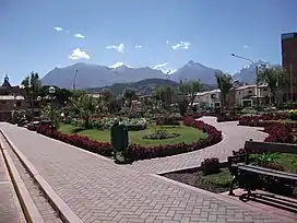
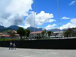
 Ranrapalca (in the distance), Rima Rima, Churup (middle, left), Collapaco and Huamashraju as seen from Huaraz
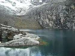
 Churup Lake at the foot of the mountain
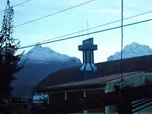
 The mountains Rima Rima and Churup as seen from Huaraz
References
- Neate, Jill (1994). "Peru". Mountaineering in the Andes (PDF). RGS-IBG Expedition Advisory Centre. p. 13. ISBN 0-907649-64-5. Archived from the original (PDF) on 2016-03-04.
- "Nevado Churup". mincetur. Retrieved August 21, 2014.
- Díaz, Felipe (2008–2009). Carta Turística. Cordilleras Blanca, Negra, Huayhuash y Callejón de Huaylas.
- Alpenvereinskarte 0/3b. Cordillera Blanca Süd (Peru). 1:100 000. Oesterreichischer Alpenverein. 2005. ISBN 3-937530-05-3.
- escale.minedu.gob.pe - UGEL map of the Huaraz Province (Ancash Region) showing Churup labelled "Nevado Huamanrripa"
This article is issued from Wikipedia. The text is licensed under Creative Commons - Attribution - Sharealike. Additional terms may apply for the media files.