Chylonia
Chylonia is a district of Gdynia, Poland,[2] located in the northern part of the city.
Chylonia | |
|---|---|
District of Gdynia | |
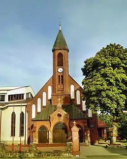 Saint Nicholas church | |
 Coat of arms | |
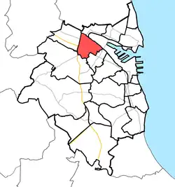 Location of Chylonia within Gdynia | |
| Coordinates: 54°32′32″N 18°27′56″E | |
| Country | |
| Voivodeship | Pomeranian |
| County/City | Gdynia |
| Within city limits | 1930 |
| Area | |
| • Total | 3.84 km2 (1.48 sq mi) |
| Population (2022[1]) | |
| • Total | 20,450 |
| • Density | 5,300/km2 (14,000/sq mi) |
| Time zone | UTC+1 (CET) |
| • Summer (DST) | UTC+2 (CEST) |
| Vehicle registration | GA |
Chylonia was a royal village of the Kingdom of Poland, administratively located in the Puck County in the Pomeranian Voivodeship.[3]
During the German occupation of Poland in World War II, in 1939, the occupiers operated a temporary transit camp for expelled Poles in Chylonia.[4]
Transport
The Gdynia Chylonia and Gdynia Leszczynki railway stations are located in Chylonia.
References
- "Dzielnice". BIP UM Gdynia (in Polish). Retrieved 25 February 2023.
- Rozporządzenie Ministra Administracji i Cyfryzacji z dnia 13 grudnia 2012 r. w sprawie wykazu urzędowych nazw miejscowości i ich części, Dz. U. z 2013 r. poz. 200
- Biskup, Marian; Tomczak, Andrzej (1955). Mapy województwa pomorskiego w drugiej połowie XVI w. (in Polish). Toruń. p. 100.
{{cite book}}: CS1 maint: location missing publisher (link) - Tomkiewicz, Monika (2021). "Gdynia – miasto wysiedlone (1939–1942)". Oblicza Wojny (in Polish). Łódź: Wydawnictwo Uniwersytetu Łódzkiego. 4: 276. ISBN 978-83-8220-617-3.
This article is issued from Wikipedia. The text is licensed under Creative Commons - Attribution - Sharealike. Additional terms may apply for the media files.