Clendon Park
Clendon Park is a suburb of Auckland in northern New Zealand. It is located to the west of Manurewa and north of Weymouth. The suburb is in the Manurewa-Papakura ward,[3] one of the 21 local boards of Auckland Council.[4]
Clendon Park | |
|---|---|
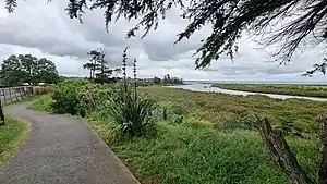 Clendon Park Reserve Park | |
| Coordinates: 37.0323°S 174.8693°E | |
| Country | New Zealand |
| City | Auckland |
| Local authority | Auckland Council |
| Electoral ward | Manurewa-Papakura ward |
| Local board | Manurewa Local Board |
| Area | |
| • Land | 180 ha (440 acres) |
| Population (June 2023)[2] | |
| • Total | 9,860 |
| Manukau Harbour | Wiri | Homai, Manurewa |
| Manukau Harbour |
|
|
| Manukau Harbour | Weymouth | Wattle Downs |
History
Clendon Park is named after Captain James Reddy Clendon who in 1840 traded land he owned in the Bay of Islands with the newly formed New Zealand Government for 10,000 acres (40 km2) of land, then south of Auckland CBD.[5]
The name Clendon Park was chosen in October 1976 by the Manukau City Council.
Clendon Park's first stage of development was at Finlayson Avenue, where the Clendon Park Community House opened in April 1979. The first stage of the Clendon Park Shopping Centre opened in 1984. The development later expanded south to Weymouth.[6]
Demographics
Clendon Park covers 1.80 km2 (0.69 sq mi)[1] and had an estimated population of 9,860 as of June 2023,[2] with a population density of 5,478 people per km2.
| Year | Pop. | ±% p.a. |
|---|---|---|
| 2006 | 7,965 | — |
| 2013 | 7,794 | −0.31% |
| 2018 | 8,871 | +2.62% |
| Source: [7] | ||
Clendon Park had a population of 8,871 at the 2018 New Zealand census, an increase of 1,077 people (13.8%) since the 2013 census, and an increase of 906 people (11.4%) since the 2006 census. There were 1,986 households, comprising 4,347 males and 4,524 females, giving a sex ratio of 0.96 males per female, with 2,760 people (31.1%) aged under 15 years, 2,337 (26.3%) aged 15 to 29, 3,399 (38.3%) aged 30 to 64, and 381 (4.3%) aged 65 or older.
Ethnicities were 16.6% European/Pākehā, 29.6% Māori, 55.4% Pacific peoples, 16.5% Asian, and 1.8% other ethnicities. People may identify with more than one ethnicity.
The percentage of people born overseas was 34.2, compared with 27.1% nationally.
Although some people chose not to answer the census's question about religious affiliation, 23.4% had no religion, 55.3% were Christian, 4.0% had Māori religious beliefs, 6.9% were Hindu, 3.1% were Muslim, 0.7% were Buddhist and 1.7% had other religions.
Of those at least 15 years old, 522 (8.5%) people had a bachelor's or higher degree, and 1,341 (21.9%) people had no formal qualifications. 330 people (5.4%) earned over $70,000 compared to 17.2% nationally. The employment status of those at least 15 was that 2,946 (48.2%) people were employed full-time, 594 (9.7%) were part-time, and 513 (8.4%) were unemployed.[7]
| Name | Area (km2) | Population | Density (per km2) | Households | Median age | Median income |
|---|---|---|---|---|---|---|
| Clendon Park North | 0.75 | 3,339 | 4,452 | 741 | 26.1 years | $24,000[8] |
| Clendon Park West | 0.46 | 3,261 | 7,089 | 720 | 25.6 years | $23,500[9] |
| Clendon Park East | 0.59 | 2,271 | 3,849 | 525 | 25.0 years | $21,800[10] |
| New Zealand | 37.4 years | $31,800 |
Education
Waimahia Intermediate School is an intermediate school (years 7–8), with a roll of 226.[11]
Clendon Park School, Te Matauranga and Roscommon School are contributing primary schools (years 1–6), with rolls of 603, 326 and 469 students, respectively.[12][13][14] Clendon Park School opened in 1971.[15] Te Matauranga has some Samoan classes up to year 8.
Te Kura Kaupapa Māori o Manurewa is a full primary school (years 1–8), with a roll of 67.[16]
All these schools are coeducational. Te Kura Kaupapa Māori o Manurewa teaches primarily in the Māori language.[17] All other schools here include classes in Māori and Samoan languages.[18][19][20][21] Rolls are as of April 2023.[22]
See also
References
- "ArcGIS Web Application". statsnz.maps.arcgis.com. Retrieved 12 August 2022.
- "Population estimate tables - NZ.Stat". Statistics New Zealand. Retrieved 25 October 2023.
- "Manukau & Howick Wards Postcode Boundaries" (PDF). New Zealand Post. Retrieved 12 April 2017.
- "Local Boards". Auckland Council. Retrieved 12 April 2017.
- Phoebe Falconer (15 July 2014). "Ask Phoebe: How Auckland landmarks got their names". The New Zealand Herald. Retrieved 12 April 2017.
- "CLENDON PARK (often referred to simply as Clendon)". kura.aucklandlibraries.govt.nz. Retrieved 19 December 2022.
- "Statistical area 1 dataset for 2018 Census". Statistics New Zealand. March 2020. Clendon Park North (158700), Clendon Park West (159500) and Clendon Park East (159700).
- 2018 Census place summary: Clendon Park North
- 2018 Census place summary: Clendon Park West
- 2018 Census place summary: Clendon Park East
- Education Counts: Waimahia Intermediate
- Education Counts: Clendon Park School
- Education Counts: Te Matauranga
- Education Counts: Roscommon School
- "Our History". Clendon Park School. Retrieved 14 September 2020.
- Education Counts: Te Kura Kaupapa Māori o Manurewa
- "Te Kura Kaupapa Māori o Manurewa - 12/01/2017". Education Review Office. 12 January 2017.
- "Waimahia Intermediate School - 07/10/2019". Education Review Office. 7 October 2019.
- "Clendon Park School - 12/11/2015". Education Review Office. 12 November 2015.
- "Te Matauranga - 07/09/2017". Education Review Office. 7 September 2017.
- "Roscommon School - 21/12/2017". Education Review Office. 21 December 2017.
- "New Zealand Schools Directory". New Zealand Ministry of Education. Retrieved 12 December 2022.
External links
- Photographs of Clendon Park held in Auckland Libraries' heritage collections.