Marco Island, Florida
Marco Island is a city and barrier island in Collier County, Florida, located 20 miles (32 km) south of Naples on the Gulf Coast of the United States. It is the largest barrier island within Southwest Florida's Ten Thousand Islands area, which extends southerly to Cape Sable. Marco Island is home to an affluent beach community with resort amenities.
Marco Island, Florida | |
|---|---|
| City of Marco Island | |
 | |
| Nickname: La Isla de San Marco | |
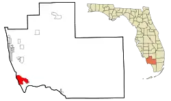 Location in Collier County and the state of Florida | |
| Coordinates: 25°58′21″N 81°43′44″W[1] | |
| Country | United States |
| State | Florida |
| County | Collier |
| Area | |
| • Total | 24.66 sq mi (63.88 km2) |
| • Land | 12.16 sq mi (31.49 km2) |
| • Water | 12.51 sq mi (32.39 km2) |
| Elevation | 10 ft (3 m) |
| Population (2020) | |
| • Total | 15,760 |
| • Density | 1,296.37/sq mi (500.52/km2) |
| Time zone | UTC-5 (Eastern (EST)) |
| • Summer (DST) | UTC-4 (EDT) |
| ZIP Codes | 34145–34146 |
| Area code | 239 |
| FIPS code | 12-43083[3] |
| GNIS feature ID | 0286403[1] |
| Website | Official website |
Two bridges provide road access to the island via Florida State Road 951 and County Road 92.
There are two public access locations with parking and amenities (Tigertail and South Beach), a private beach complex for residents (Residents' Beach), and a private parking area for residents (Sarazen Park at South Beach), and two other public access points (with no amenities). Offshore island beaches, such as Keewaydin, are accessible by boat or tour.
Marco Island is a principal city of the Naples–Marco Island Metropolitan Statistical Area. The population was 15,760 at the 2020 census.[4] The population more than doubles in size during the winter season.
Parts of the island have some scenic, high elevations relative to the generally flat south Florida landscape. The island has a tropical climate; specifically a tropical wet and dry or savanna type (Aw under the Köppen system). It is known for its distinct wet and dry seasons, with most of the rainfall falling between the months of June and October.
History
The history of Marco Island can be traced as far back as 500 CE when the Calusa people inhabited the island as well as the rest of southwest Florida. A number of Calusa artifacts were discovered on Key Marco (an island then adjacent to, and since attached to Marco Island) in 1896 by anthropologist Frank Hamilton Cushing as part of the Pepper-Hearst Expedition. The most notable artifact discovered was the carved wooden "Key Marco Cat,"[5] which is now on display at the Smithsonian Institution.[6] The artifact is featured on a 1989 postage stamp.[7]
When Spanish explorers came to the island in the mid-1500s, they gave the island the name La Isla de San Marcos after Gospel writer St. Mark.[8]
Early development of the island began in the late 1800s after the arrival of William Thomas Collier and his family. Collier founded the village of Marco on the island in 1870, and in 1896 Collier's son, William D. "Capt. Bill" Collier, opened a hotel on the island, known today as the Olde Marco Inn.[9]
Clam digging became a major industry on Marco Island and throughout the Ten Thousand Islands in the early 1900s. The Burnham Clam Cannery began operation near Caxambas Pass in 1903 and operated until 1929. The Doxsee Clam Cannery also operated from 1911 to 1947.
Ferry service began to the island in 1912, which operated between Marco Island and the Isles of Capri. A road on the mainland linked the ferry landing with East Naples (just west of State Road 951). A small piece of this road still exists today and is known as Barefoot Williams Road.[10]
Barron G. Collier (whom Collier County is named after, and of no relation to William T. Collier) purchased a large amount of land on Marco Island in 1922, and in 1927 the island incorporated as Collier City. Collier City was abolished in 1957. James Harvey Doxsee Sr. served as Collier City's only mayor.[11]
Also in 1927, the Atlantic Coast Line Railroad began service to the island after extending their route from Fort Myers and Naples. The railroad ran to the island along the present route of State Road 951. Rail service was discontinued in 1944.[12]
The first vehicle bridge to the island was a small wooden swing bridge built in 1938 near Goodland on the southeast side of the island. Remnants of this bridge can be seen today next to the current Goodland Bridge (built in 1975). The island's ferry service was discontinued after the original Goodland Bridge opened.
Significant development of Marco Island took place in the 1960s that made it into the tourist destination it is known as today. The Mackle brothers of the Deltona Corporation led the development of the island after purchasing large amounts of land there for $7 million. As a result of development, the S.S. Jolley Bridge opened for traffic in 1969.[13]
Marco Island was reincorporated as a city on August 28, 1997.[14]
On September 10, 2017, Hurricane Irma made landfall as a Category 3 hurricane on the island.[15]
Geography
Marco Island is located in southwestern Collier County,[16] along the Gulf of Mexico.
According to the United States Census Bureau, the city has a total area of 22.8 square miles (59.0 km2), of which 12.1 square miles (31.4 km2) is land and 10.7 square miles (27.6 km2) (46.73%) is water.[17]
Climate
Marco Island has a tropical climate which borders on a humid subtropical climate since the mean temperature in the coldest month, January, is 64.4 °F (18.0 °C) which is barely over the 64 °F (18 °C) threshold for a tropical climate.
| Climate data for Marco Island, Florida, 1991–2020 normals, extremes 2002–present | |||||||||||||
|---|---|---|---|---|---|---|---|---|---|---|---|---|---|
| Month | Jan | Feb | Mar | Apr | May | Jun | Jul | Aug | Sep | Oct | Nov | Dec | Year |
| Record high °F (°C) | 86 (30) |
87 (31) |
88 (31) |
93 (34) |
95 (35) |
97 (36) |
98 (37) |
97 (36) |
96 (36) |
94 (34) |
92 (33) |
87 (31) |
98 (37) |
| Mean maximum °F (°C) | 81.7 (27.6) |
82.1 (27.8) |
84.0 (28.9) |
88.3 (31.3) |
91.5 (33.1) |
94.1 (34.5) |
94.1 (34.5) |
94.3 (34.6) |
93.3 (34.1) |
90.9 (32.7) |
86.8 (30.4) |
83.5 (28.6) |
95.1 (35.1) |
| Average high °F (°C) | 73.9 (23.3) |
76.2 (24.6) |
78.9 (26.1) |
83.2 (28.4) |
87.5 (30.8) |
90.1 (32.3) |
91.1 (32.8) |
91.5 (33.1) |
90.0 (32.2) |
86.9 (30.5) |
80.5 (26.9) |
76.8 (24.9) |
83.9 (28.8) |
| Daily mean °F (°C) | 64.4 (18.0) |
66.7 (19.3) |
69.4 (20.8) |
74.1 (23.4) |
78.6 (25.9) |
82.2 (27.9) |
83.5 (28.6) |
83.8 (28.8) |
82.6 (28.1) |
78.8 (26.0) |
72.0 (22.2) |
67.7 (19.8) |
75.3 (24.1) |
| Average low °F (°C) | 54.9 (12.7) |
57.1 (13.9) |
59.9 (15.5) |
64.9 (18.3) |
69.7 (20.9) |
74.2 (23.4) |
75.8 (24.3) |
76.2 (24.6) |
75.2 (24.0) |
70.7 (21.5) |
63.4 (17.4) |
58.6 (14.8) |
66.7 (19.3) |
| Mean minimum °F (°C) | 39.0 (3.9) |
42.5 (5.8) |
46.7 (8.2) |
55.3 (12.9) |
62.5 (16.9) |
70.0 (21.1) |
72.3 (22.4) |
72.0 (22.2) |
71.5 (21.9) |
59.5 (15.3) |
49.9 (9.9) |
45.9 (7.7) |
36.9 (2.7) |
| Record low °F (°C) | 28 (−2) |
31 (−1) |
39 (4) |
47 (8) |
58 (14) |
66 (19) |
69 (21) |
67 (19) |
65 (18) |
45 (7) |
42 (6) |
32 (0) |
28 (−2) |
| Average precipitation inches (mm) | 2.50 (64) |
1.91 (49) |
2.05 (52) |
2.48 (63) |
3.38 (86) |
8.36 (212) |
6.60 (168) |
9.16 (233) |
9.92 (252) |
3.21 (82) |
2.02 (51) |
1.71 (43) |
53.30 (1,354) |
| Average precipitation days (≥ 0.01 in) | 5.3 | 4.7 | 4.3 | 5.0 | 8.7 | 15.9 | 15.8 | 18.8 | 17.5 | 8.6 | 5.4 | 5.1 | 115.1 |
| Source: NOAA (mean maxima/minima 2006–2020)[18][19] | |||||||||||||
Demographics
| Census | Pop. | Note | %± |
|---|---|---|---|
| 1980 | 4,694 | — | |
| 1990 | 9,493 | 102.2% | |
| 2000 | 14,879 | 56.7% | |
| 2010 | 16,413 | 10.3% | |
| 2020 | 15,760 | −4.0% | |
| U.S. Decennial Census[20] | |||
2020 census
| Race | Number | Percentage |
|---|---|---|
| White (NH) | 13,999 | 88.83% |
| Black or African American (NH) | 53 | 0.34% |
| Native American or Alaska Native (NH) | 19 | 0.12% |
| Asian (NH) | 175 | 1.11% |
| Pacific Islander (NH) | 1 | 0.01% |
| Some Other Race (NH) | 32 | 0.2% |
| Mixed/Multi-Racial (NH) | 324 | 2.06% |
| Hispanic or Latino | 1,157 | 7.34% |
| Total | 15,760 |
As of the 2020 United States census, there were 15,760 people, 8,379 households, and 5,714 families residing in the city.
2010 census
As of the census[22] of 2010, there were 16,413 people, 7,517 households, and 17,134 housing units in the city. The population density was 1,352.0 inhabitants per square mile (522.0/km2). There were 14,826 housing units at an average density of 1,402.1 per square mile (12.14 square miles). The racial makeup of the city was 95.9% White, 0.5% African American, 0.1% American Indian, 1.1% Asian and 7.1% Hispanic or Latino.
There were 7,517 households, out of which 9.4% had children under the age of 18 living with them, 46.7% were 65 years of age or older. The average household size was 2.21.
The median income for a household in the city was $73,373, and the per capita income was $52,089. 2.1% of the population were below the poverty level.
Political affiliation
Marco Island generally supports the Republican Party, as the city is both represented in the House by Republican Byron Donalds and voted in favor of Republican incumbent Donald Trump during the 2020 election at margins varying from 62% to 73% over Democratic nominee Joe Biden. The region, however, voted more so in favor of the Democratic Party than it did during the 2016 election.[23]
Education
The District School Board of Collier County operates the following schools serving Marco Island:
- Marco Island Academy High School[24]
- Marco Island Charter Middle School[25]
- Tommie Barfield Elementary School[26]
Private schools:
- Island Montessori Academy
- Marketplace Mission Learning Center
Transportation
The Marco Island Executive Airport (MRK) provides general aviation service to the area. It is located 4 miles (6.4 km) northeast of the central business district of Marco Island. The closest regularly-scheduled commercial flights to the area arrive at Southwest Florida International Airport.
Marco Island is served by Collier Area Transit's Route #21 and Route #121 (Express: Immokalee to Marco Island)[27]
Notable people
See also
References
- U.S. Geological Survey Geographic Names Information System: Marco Island, Florida
- "2020 U.S. Gazetteer Files". United States Census Bureau. Retrieved October 31, 2021.
- "U.S. Census website". United States Census Bureau. Retrieved January 31, 2008.
- "Marco Island city, Florida Census". United States Census Bureau.
- "Nine Lives Well Lived". Florida Museum. March 27, 2021. Retrieved January 12, 2022.
- "The Key Marco Artifacts".
- "45c Pre-Columbian American single". Smithsonian National Postal Museum. Retrieved June 20, 2021.
- "Marco Island's History". Marco Island Visitor Guide. Retrieved March 5, 2014.
- "Historical Markers of Marco Island". Marco Sun. Retrieved March 5, 2014.
- Cousineau, Bonnie Jean. "Barefoot Williams". Naples, Florida History. Naples Historical Society. Retrieved March 5, 2014.
- Layden, Laura (April 3, 2012). "Lighthouse Project - History: Marco began as a place for catching, canning clams". Naples Daily News. Retrieved March 5, 2014.
- Turner, Gregg M. (December 1, 1999). Railroads of Southwest Florida. Images of America. Arcadia Publishing.
- "Modern Marco". Marco Island Historical Society. Retrieved March 5, 2014.
- "Present Day Marco Island". City of Marco Island. Retrieved March 5, 2014.
- "Hurricane Irma". Los Angeles Times. Retrieved September 10, 2017.
- "US Gazetteer files: 2010, 2000, and 1990". United States Census Bureau. February 12, 2011. Retrieved April 23, 2011.
- "Geographic Identifiers: 2010 Demographic Profile Data (G001): Marco Island city, Florida". U.S. Census Bureau, American Factfinder. Archived from the original on February 12, 2020. Retrieved June 27, 2014.
- "NOWData - NOAA Online Weather Data". National Oceanic and Atmospheric Administration. Retrieved May 14, 2021.
- "Summary of Monthly Normals 1991–2020". National Oceanic and Atmospheric Administration. Retrieved May 14, 2021.
- "Census of Population and Housing". Census.gov. Retrieved June 4, 2015.
- "Explore Census Data". data.census.gov. Retrieved February 12, 2022.
- "Marco Island (City) QuickFacts from the US Census Bureau". Archived from the original on May 8, 2012. Retrieved July 12, 2012.
- Park, Alice; Smart, Charlie; Taylor, Rumsey; Watkins, Miles (February 2, 2021). "An Extremely Detailed Map of the 2020 Election". The New York Times. ISSN 0362-4331. Retrieved October 25, 2022.
- "Marco Island Academy". www.marcoislandacademy.com.
- "Marco Island Charter Middle School". micms.org.
- "Tommie Barfield Elementary / Homepage". collier.k12.fl.us.
- "Collier County : CAT Maps & Schedule". Archived from the original on October 13, 2013. Retrieved November 26, 2013.
- "House Speaker John Boehner bringing tan, tears to Marco Island after buying luxury condo". February 20, 2014.
- Megan, Graydon (January 16, 2013). "William Cullerton, 1923-2013 WWII pilot, entrepreneur, radio host and well-known outdoorsman championed conservation". Chicago Tribune. Retrieved January 25, 2013.
- "Leighton Meester: From High School Drama to Parenthood". September 19, 2018.
External links
Municipalities and communities of Collier County, Florida, United States | ||
|---|---|---|
| Cities |  | |
| CDPs | ||
| Unincorporated communities | ||
| Proposed communities | ||
| Ghost towns | ||