Lindenthal, Cologne
Lindenthal (German: Köln-Lindenthal [ˈkœln ˈlɪndn̩ˌtaːl], Kölsch: Lendethal [ˈlendəˌtaːl]) is a borough of the City of Cologne in Germany. It includes the quarters Braunsfeld, Junkersdorf, Klettenberg, Lindenthal, Lövenich, Müngersdorf, Sülz, Weiden and Widdersdorf. It has about 153,000 inhabitants (as of December 2019) and covers an area of 41.8 square kilometers.
Lindenthal (3) | |
|---|---|
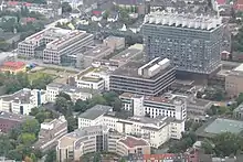
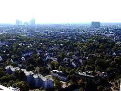 Aerial view | |
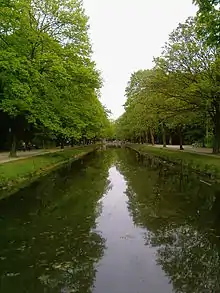
Location within Cologne 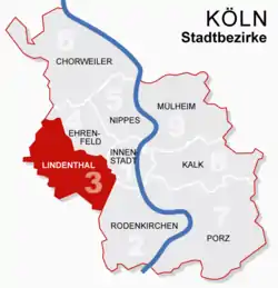 | |
 Lindenthal (3) 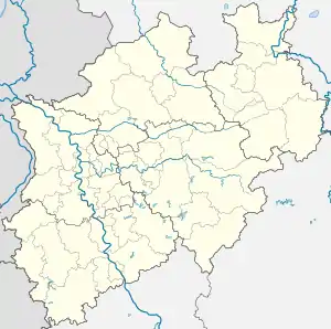 Lindenthal (3) | |
| Coordinates: 50°55′34″N 6°54′36″E | |
| Country | Germany |
| State | North Rhine-Westphalia |
| Admin. region | Cologne |
| District | Urban district |
| City | Cologne |
| Area | |
| • Total | 41.80 km2 (16.14 sq mi) |
| Population (2020-12-31)[1] | |
| • Total | 152,286 |
| • Density | 3,600/km2 (9,400/sq mi) |
| Time zone | UTC+01:00 (CET) |
| • Summer (DST) | UTC+02:00 (CEST) |
Many parts of Lindenthal are dominated by academic and research campuses, primarily linked to the University of Cologne and the German Sport University. The latter has a campus at Sportpark Müngersdorf, next to RheinEnergieStadion and the European College of Sport Science.
The Cologne University Hospital has a vast campus around the Kerpener Straße. Other institutions include the Max Planck Institutes for Biology of Ageing and Plant Breeding Research.
Cologne's Melaten-Friedhof is located on Aachener Straße.
History
During the Cold War, the headquarters of the I Belgian Corps was located in Junkersdorf.
Subdivisions
Lindenthal consists of nine Stadtteile (city quarters, in local dialect Veedel):
| # | City part | Population (2019) | Area (km2) | Pop. per km2 | map |
|---|---|---|---|---|---|
| 301 | Klettenberg | 10,679 | 1,80 | 5,942 | 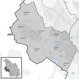 |
| 302 | Sülz | 36,432 | 5,17 | 7,102 | |
| 303 | Lindenthal | 30,685 | 7,73 | 3,970 | |
| 304 | Braunsfeld | 12,312 | 1,68 | 7,342 | |
| 305 | Müngersdorf | 8,833 | 5,10 | 1,733 | |
| 306 | Junkersdorf | 15,263 | 7,38 | 2,069 | |
| 307 | Weiden | 17,478 | 3,65 | 4,782 | |
| 308 | Lövenich | 9,205 | 3,69 | 2,493 | |
| 309 | Widdersdorf | 12,413 | 5,60 | 2,217 | |
| Source: Kölner Stadtteilinformationen Einwohnerzahlen 2019 (in German) | |||||
Transportation
Lindenthal is served by numerous railway stations and highway. Train station include Köln-Lövenich, Köln-Müngersdorf/Technologiepark and Köln-Weiden West, as well as numerous light rail stations of Cologne Stadtbahn lines 1, 7, 9, 13 and 18. Aachener Straße and Luxemburger Straße connect Lindenthal with the Cologne Ring and Cologne Beltway.
Twin towns – sister cities
Lindenthal is "twinned" with the following cities:[2]
 Benfleet, United Kingdom
.svg.png.webp) Diepenbeek, Belgium
Diepenbeek, Belgium Igny, France
References
- "Kölner Stadtteilinformationen 2020" (PDF). Stadt Köln. Retrieved 27 September 2021.
- "Partnerstädte". Retrieved 22 June 2009.
External links
![]() Media related to Köln-Lindenthal (District) at Wikimedia Commons
Media related to Köln-Lindenthal (District) at Wikimedia Commons
- Official webpage of the district (in German)
| ||