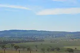
Coolah Parish, New South Wales
Coolah Parish is a civil parish of the County of Napier,[3] a county in the central western part of New South Wales, Australia in Warrumbungle Shire.[2] The only town of the parish is Coolah, New South Wales and at the 2006 census, Coolah township had a population of 910.[1]
| Coolah New South Wales | |
|---|---|
 Coolah Parish | |
 Coolah | |
| Coordinates | 31°50′0″S 149°43′0″E |
| Population | 1,290 (2016 census)[1] |
| Postcode(s) | 2843 |
| Location | |
| LGA(s) | Warrumbungle Shire |
| County | Napier County[2] |
| State electorate(s) | Barwon |
| Federal division(s) | Parkes |
History
Before European settlement the area was occupied by the Gamilaroi and Wiradjuri peoples.
Allan Cunningham was the first British explorer to discover the area in 1823 while travelling Pandoras Pass over the Warrumbungle ranges to the Liverpool Plains. On the northeastern side of the area is the Liverpool Range with the Coolah Tops National Park. Most of the region is agricultural with sheep and cattle raising and crops grown along the Talbragar River and Coolaburragundy River valleys.
The town of Coolah, New South Wales is the main settlement of the parish.[4]
References
- Australian Bureau of Statistics (25 October 2007). "Coolah (L) (Urban Centre/Locality)". 2006 Census QuickStats. Retrieved 28 November 2008.
- "Napier County". Geographical Names Register (GNR) of NSW. Geographical Names Board of New South Wales.
- Robert McLean, The New Atlas of Australia : the complete work containing over one hundred maps and full descriptive geography of New South Wales, Victoria, Queensland, South Australia and Western Australia, together with numerous illustrations and copious indices (Sydney :J. Sands, [1886) Map 14.
- Department of Lands, Sydney N.S.W , Map of the County of Napier, Central Division, N.S.W. (Published Sydney : Dept. of Lands, 1964).