Les Coteaux, Quebec
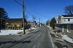
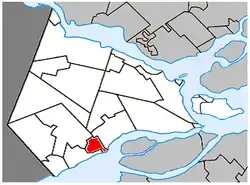
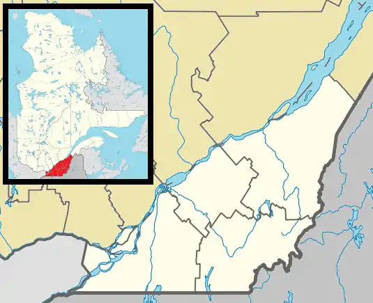
Les Coteaux is a municipality in Vaudreuil-Soulanges Regional County Municipality in the Montérégie region of Quebec, Canada. It is located north of the Saint Lawrence River and Salaberry-de-Valleyfield.
Les Coteaux | |
|---|---|
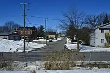
 Coteau-Station sector | |
 Location within Vaudreuil-Soulanges RCM | |
 Les Coteaux Location in southern Quebec | |
| Coordinates: 45°17′N 74°14′W[1] | |
| Country | |
| Province | |
| Region | Montérégie |
| RCM | Vaudreuil-Soulanges |
| Constituted | 18 May 1994 |
| Government | |
| • Mayor | Sylvain Brazeau |
| • Federal riding | Salaberry—Suroît |
| • Prov. riding | Soulanges |
| Area | |
| • Total | 14.50 km2 (5.60 sq mi) |
| • Land | 11.63 km2 (4.49 sq mi) |
| Population (2016)[4] | |
| • Total | 5,368 |
| • Density | 461.4/km2 (1,195/sq mi) |
| • Pop 2011-2016 | |
| • Dwellings | 2,285 |
| Time zone | UTC−5 (EST) |
| • Summer (DST) | UTC−4 (EDT) |
| Postal code(s) | |
| Area code(s) | 450 and 579 |
| Highways | |
| Website | www |
It was formed from the merger in 1994 of Coteau-Station (north of Autoroute 20) and Coteau-Landing (south of Autoroute 20). Prior to 1985, Coteau-Station had been known as Station-du-Coteau.[5]
History
Coteau-Landing was the historic location at the upper end of rapids on the St. Lawrence River where canoeing and boating parties had to land in order to portage around the rapids. It was formerly called Anse-aux-Batteaux (English: Cove of Boats). At the end of the 17th century, a staging post was built there for voyageurs and fur traders. But it was not until 1771 that settlement really began.[1]
In 1847, its post office opened under the English name "Coteau Landing". In 1853, the Village Municipality of Côteau Landing was created (orthography was later changed to "Coteau-Landing"). When Soulanges County was formed in 1855, the village became the county seat. When the Soulanges Canal was completed with Coteau-Landing as its western terminus, its economy was boosted by the presence of a lock and relay center with quays and wharfs. It also had a regular paddle steamer service to Salaberry-de-Valleyfield.[1]
The Grand Trunk Railway was constructed in 1855 with a station just north of Coteau Landing, called Coteau Junction. In 1887, the Village Municipality of Station du Coteau was created out of territory ceded from Saint-Polycarpe. Its name was adjusted to La Station-du-Coteau, and renamed in 1984 to Coteau-Station.[1]
In May 1994, the village municipalities of Coteau-Landing and Coteau-Station were amalgamated to form the Municipality of Coteaux (adjusted to Les Coteaux in June 1995).[6]
Demographics
| 2021 | 2016 | 2011 | |
|---|---|---|---|
| Population | 5,643 (+5.1% from 2016) | 5,368 (+17.5% from 2011) | 4,568 (+21.4% from 2006) |
| Land area | 11.64 km2 (4.49 sq mi) | 11.63 km2 (4.49 sq mi) | 11.62 km2 (4.49 sq mi) |
| Population density | 485/km2 (1,260/sq mi) | 461.4/km2 (1,195/sq mi) | 393.2/km2 (1,018/sq mi) |
| Median age | 38.8 (M: 37.6, F: 40) | 37.0 (M: 35.9, F: 37.9) | 35.7 (M: 35.3, F: 36.2) |
| Private dwellings | 2,415 (total) | 2,285 (total) | 1,931 (total) |
| Median household income | $67,677 | $60,437 |
|
| |||||||||||||||||||||||||||||||||
| Population amounts prior to 1994 are total of Coteau-Landing (VL) and Coteau-Station (VL). Source: Statistics Canada[12] | ||||||||||||||||||||||||||||||||||
Language
| Canada Census Mother Tongue - Les Coteaux, Quebec[12] | ||||||||||||||||||
|---|---|---|---|---|---|---|---|---|---|---|---|---|---|---|---|---|---|---|
| Census | Total | French |
English |
French & English |
Other | |||||||||||||
| Year | Responses | Count | Trend | Pop % | Count | Trend | Pop % | Count | Trend | Pop % | Count | Trend | Pop % | |||||
2016 |
5,570 |
4,940 | 92.0% | 255 | 4.7% | 90 | 1.7% | 70 | 1.3% | |||||||||
2011 |
4,530 |
4,215 | 93.05% | 220 | 4.86% | 50 | 1.10% | 45 | 0.99% | |||||||||
2006 |
3,730 |
3,450 | 92.49% | 180 | 4.83% | 60 | 1.61% | 40 | 1.07% | |||||||||
2001 |
2,960 |
2,845 | 96.11% | 90 | 3.04% | 10 | 0.34% | 15 | 0.51% | |||||||||
1996 |
2,740 |
2,605 | n/a | 95.07% | 125 | n/a | 4.56% | 0 | n/a | 0.00% | 10 | n/a | 0.37% | |||||

Local government
List of former mayors (since formation of current municipality):[6]
- Réal Boisvert (1994–2013)
- Denise Godin Dostie (2013–2021)
- Sylvain Brazeau (2021–present)
Education
Commission Scolaire des Trois-Lacs operates Francophone schools.[13]
- École Léopold-Carrière
Lester B. Pearson School Board operates Anglophone schools.[14]
- Soulanges Elementary School in Saint-Télesphore or Evergreen Elementary and Forest Hill Elementary (Junior Campus and Senior campus) in Saint-Lazare
See also
References
- "Reference number 289307 in Banque de noms de lieux du Québec". toponymie.gouv.qc.ca (in French). Commission de toponymie du Québec.
- "Ministère des Affaires Municipales et Regions Quebec Ministère des Affaires municipales, des Régions et de l'Occupation du territoire: Les Coteaux". Archived from the original on 23 February 2014. Retrieved 11 March 2012.
- "Parliament of Canada Federal Riding History: VAUDREUIL--SOULANGES (Quebec)". Archived from the original on 18 June 2009. Retrieved 22 March 2009.
- "Les Coteaux, Quebec (Code 2471033) Census Profile". 2016 census. Government of Canada - Statistics Canada.
- Isabelle Lord (1 October 2008). "Les Coteaux". L'Étoile. Archived from the original on 31 May 2014. Retrieved 26 January 2012.
- "Répertoire des entités géopolitiques: Les Coteaux (municipalité) 18.5.1994 - ..." www.mairesduquebec.com. Institut généalogique Drouin. Retrieved 26 November 2021.
- "2021 Community Profiles". 2021 Canadian Census. Statistics Canada. 4 February 2022. Retrieved 27 April 2022.
- "2016 Community Profiles". 2016 Canadian Census. Statistics Canada. 12 August 2021. Retrieved 26 November 2021.
- "2011 Community Profiles". 2011 Canadian Census. Statistics Canada. 21 March 2019. Retrieved 6 February 2014.
- "2006 Community Profiles". 2006 Canadian Census. Statistics Canada. 20 August 2019.
- "2001 Community Profiles". 2001 Canadian Census. Statistics Canada. 18 July 2021.
- 1996, 2001, 2006, 2011 census
- "Les écoles et les centres". Commission Scolaire des Trois-Lacs. Retrieved 18 January 2013.
- "School Board Map." Lester B. Pearson School Board. Retrieved on September 28, 2017.
External links
![]() Media related to Les Coteaux, Quebec at Wikimedia Commons
Media related to Les Coteaux, Quebec at Wikimedia Commons