Counamama
Counamama is a river in French Guiana that has its source in the mountains in the south of the Iracoubo municipality. It passes the eponymous town, and flows into the Iracoubo River near the coast. The Iracoubo empties into the Atlantic Ocean 5 kilometres (3.1 mi) later.[1][2][3] The Counamama is 106 kilometres (66 mi) long.[3]
| Counamama | |
|---|---|
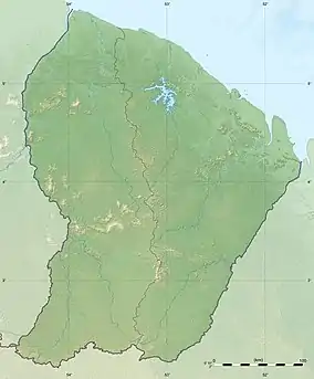 Location of mouth | |
| Native name | La Counamama Rivière (French) |
| Location | |
| Country | France |
| Territory | French Guiana |
| Commune | Iracoubo |
| Physical characteristics | |
| Source | |
| • coordinates | 4.98111°N 53.34419°W |
| Mouth | Atlantic Ocean |
• coordinates | 5.518678°N 53.246188°W |
| Length | 106 km |
| Basin features | |
| Progression | Iracoubo River → Atlantic Ocean |
In 1598 the Counamama was first explored by De Zeeridder and described by Abraham Cabeliau.[4]
References
- National Geospatial Intelligence Agency. "Counamama". GeoNames. Retrieved July 31, 2021.
- "Estuaire de l'Iracoubo (Identifiant national : 03M000004)" (PDF). Inventaire national du patrimoine naturel (in French). 5 July 2018. Retrieved 9 July 2022.
- "counamama, branche iracoubo, la (riviere); counamama, la (riviere)". Sandre (in French). Retrieved 9 July 2022.
- L. C. VAN PANHUYS. "A CLAIM FOR THE DISCOVERY OF THE COAST OF GUIANA BY THE DUTCH". p. 623. Retrieved July 31, 2021.
This article is issued from Wikipedia. The text is licensed under Creative Commons - Attribution - Sharealike. Additional terms may apply for the media files.