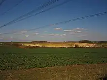
Counthorpe and Creeton
Counthorpe and Creeton is a civil parish in the South Kesteven district of Lincolnshire, England. According to the 2001 census it had a population of 97 across 45 homes.[1]
.jpg.webp)
at TF006203


Summary
The civil parish includes the hamlets of Counthorpe and Creeton, to the East of the railway line. The Western half is entirely Rural save for the stone quarries.
There are no major roads through the parish, though the London-Edinburgh railway line bisects the parish. The parish is crossed by the B1176 Swinstead to Little Bytham road on the eastern half, and at the western extremity by a minor road from Swayfield to Castle Bytham. These two north–south routes are joined by two minor roads that pass east–west through the parish, meeting at the quarry before passing under the railway line at TF006203.[2][3]
A large limestone quarry, at SK998206, is known as Creeton Quarry, even though it is properly in Counthorpe. It produces fine limestone for building purposes.[4][2] Several small streams rise in the Parish, most of which drain into the West Glen river. There are several springs near Counthorpe House. There is a steep-sided valley south of the Quarries, through which one of the springs drains North-west, falling from around 75 or 80m to just below 55m at the bottom of the valley.[2] To the east the West Glen runs in a wider U-shaped valley with an alluvial floor. The river is between 55m contours, with the land rising to east and west to more than 65m.[3]
Local Democracy takes the form of a Parish Meeting[5]
References
- "Neighbourhood statistics". 2001 census. Office for national statistics. Archived from the original on 4 March 2016. Retrieved 20 April 2013.
- Grantham: Bottesford & Colsterworth (Map) (A1 ed.). 1:25 000. OS Explorer. Ordnance survey of Great Britain. 3 January 2006. § 247. ISBN 9780319238332.
- Bourne & Heckington: Billingborough & Morton (Map) (A1 ed.). 1:25 000. OS Explorer. Ordnance survey of Great Britain. 3 January 2006. § 248. ISBN 9780319238110.
- "Limestone". Johnson Quarries group. Archived from the original on 2 August 2013. Retrieved 5 September 2013.
- "Parish Meeting". SKDC. Retrieved 4 September 2013.
- Google (5 September 2013). "Parish Outline" (Map). Google Maps. Google. Retrieved 5 September 2013.
External links
 Media related to Counthorpe and Creeton at Wikimedia Commons
- "All 23 Pastscape historical records for the parish". English Heritage. Retrieved 5 September 2013.