County of Balurga
The County of Balurga is a county (a cadastral division) in Queensland, Australia. It is located in Far North Queensland, east of Kowanyama on the Cape York Peninsula.[2] On 7 March 1901, the Governor issued a proclamation legally dividing Queensland into counties under the Land Act 1897.[3] Its schedule described Balurga thus:
Bounded on the north by the counties of Kalkah and Lukin; on the west by the county of Koolatah; on the south by the south boundaries of Koolatah, Koolatah No. 4, Koolatah No. 7, Cootah No. 2 and Cootah No. 3 Blocks; and on the east by the east boundaries of Cootah No. 3, Cootah No. 1, Goathland No.3 and Goathland No. 9.
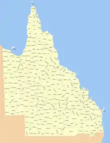
The 319 counties of Queensland in 1901.[1]
Parishes
The county is divided into civil parishes.
| Parish | LGA | Coordinates |
|---|---|---|
| Balurga | Cook | 14°55′S 142°15′E |
| Cloughton | Cook | 15°04′S 142°24′E |
| Coleman | Cook | 14°55′S 142°28′E |
| Goathland | Cook | 15°06′S 142°40′E |
| Greenhow | Cook | 15°07′S 142°54′E |
| Harkness | Cook | 15°14′S 142°38′E |
| Helmsley | Cook | 15°24′S 142°51′E |
| Ingleby | Cook | 14°59′S 142°55′E |
| Levisham | Cook | 15°12′S 142°22′E |
| Mungarda | Cook | 14°56′S 142°41′E |
| Sefton | Cook | 15°21′S 142°20′E |
| Snainton | Cook | 15°16′S 142°53′E |
| Wykeham | Cook | 15°23′S 142°35′E |
References
- Queensland showing counties / compiled and published at the Survey Department, Brisbane, Brisbane : Survey Dept., 1900.
- "Balurga (entry 1443)". Queensland Place Names. Queensland Government. Retrieved 1 September 2015.
- "A Proclamation". Queensland Government Gazette. Vol. 75. 8 March 1901. pp. 967–980.
This article is issued from Wikipedia. The text is licensed under Creative Commons - Attribution - Sharealike. Additional terms may apply for the media files.