County of Banks, Queensland
The county of Banks is one of the counties of Queensland, Australia, that existed before 1901.[1] The county is divided into civil parishes. It is located in Far North Queensland, and is named for Sir Joseph Banks, who with Captain James Cook landed in 1770 at a location within the county. Banks includes the towns of Cooktown, Lakeland and Laura.[2]
| Banks Queensland | |||||||||||||||
|---|---|---|---|---|---|---|---|---|---|---|---|---|---|---|---|
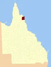 Location within Queensland | |||||||||||||||
| |||||||||||||||
Parishes
| Parish | LGA | Coordinates | Notes |
|---|---|---|---|
| Annan | Cook | 15°35′S 145°15′E | |
| Battle Camp | Cook | 15°22′S 144°39′E | |
| Bullhead | Cook | 15°50′S 144°49′E | Lakeland |
| Cahir | Cook | 15°12′S 144°39′E | |
| Cook | Cook | 15°30′S 145°14′E | Cooktown |
| Cowton | Cook | 14°59′S 144°52′E | |
| Deighton | Cook | 15°30′S 144°33′E | Laura |
| Discovery | Hope Vale (A) | 15°13′S 145°11′E | |
| Emla | Cook | 15°20′S 144°31′E | |
| Endeavour | Hope Vale (A) | 15°21′S 145°15′E | |
| Flattery | Hope Vale (A) | 14°54′S 145°11′E | |
| Gore | Cook | 15°52′S 145°04′E | |
| Green | Cook | 15°32′S 144°56′E | |
| Gresley | Cook | 15°47′S 144°30′E | |
| Hann | Hope Vale (A) | 15°20′S 145°07′E | Hope Vale |
| Hicks | Cook | 15°34′S 145°05′E | |
| Lythe | Cook | 14°57′S 144°40′E | |
| Macquarie | Cook | 15°39′S 144°34′E | |
| McIvor | Cook | 15°07′S 145°03′E | |
| Melsonby | Cook | 15°07′S 144°51′E | |
| Monkhouse | Cook | 15°45′S 145°17′E | |
| Munburra | Cook | 14°53′S 145°04′E | |
| Ninda | Cook | 15°38′S 144°46′E | |
| Pickersgill | Cook | 15°18′S 144°56′E | |
| Pryde | Cook | 15°10′S 145°01′E | |
| Ruby | Cook | 15°29′S 144°47′E | |
| Saunders | Cook | 15°39′S 144°54′E | |
| Solander | Cook | 15°27′S 145°06′E | |
| Tayeto | Hope Vale (A) | 15°03′S 145°12′E | |
| Tupia | Cook | 15°02′S 145°03′E | |
| Welbury | Cook | 15°06′S 144°39′E | |
| Yarico | Cook | 15°18′S 144°48′E |
References
- Queensland showing counties / compiled and published at the Survey Department, Brisbane, Brisbane : Survey Dept., 1900.
- Cook District, County of Banks Maps - N3 Series at Queensland Archives.
This article is issued from Wikipedia. The text is licensed under Creative Commons - Attribution - Sharealike. Additional terms may apply for the media files.