Sânandrei
Sânandrei (formerly Sântandraș; German: St. Andreas; Hungarian: Szentandrás; Serbian: Светандраш, romanized: Svetandraš) is a commune in Timiș County, Romania. It is composed of three villages: Carani, Covaci and Sânandrei (commune seat).
Sânandrei | |
|---|---|
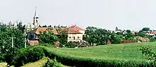
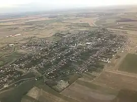 Aerial view of Sânandrei | |
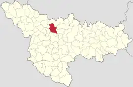 Location in Timiș County | |
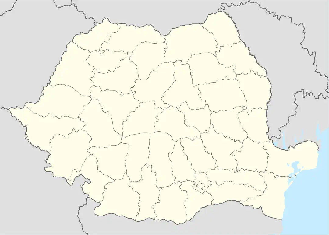 Sânandrei Location in Romania | |
| Coordinates: 45°54′38″N 21°09′51″E | |
| Country | Romania |
| County | Timiș |
| Government | |
| • Mayor (2020–2024) | Claudiu Coman[1] (PNL) |
| Area | 96.84 km2 (37.39 sq mi) |
| Elevation | 61 m (200 ft) |
| Population (2021-12-01)[3] | 7,137 |
| • Density | 74/km2 (190/sq mi) |
| Time zone | EET/EEST (UTC+2/+3) |
| Postal code | 307375–307377 |
| Vehicle reg. | TM |
| Website | primariasanandrei |
Name
| Romanian | Hungarian | German | Serbian |
|---|---|---|---|
| Carani [Merțișoara] | Mercyfalva | Mercydorf | |
| Covaci | Temeskovácsi | Kowatsch | |
| Sânandrei [Sântandraș] | Szentandrás | St. Andreas | Светандраш/Svetandraš |
Geography
Sânandrei is located in western Romania, in the south of the Western Plain, also known as the Tisa Plain, 12 km (7.5 mi) from Timișoara. The total area of Sânandrei commune, composed of the three villages of Sânandrei, Carani and Covaci, is 9,684.25 ha (23,930.3 acres), of which 444.25 ha (1,097.8 acres) is in the built-up area and 9,240 ha (22,800 acres) is outside the built-up area.[2]
History
Sânandrei
Sânandrei is one of the oldest settlements in Banat, whose first recorded mention dates from 1230, when it was owned by the chapter of Arad. In the medieval period it was a Romanian locality. In 1717 it had 23 houses and was called St. André.[4] The first colonization of the village with Germans took place in 1748–1749. The second wave of colonization took place in 1766, when French people were brought in, and in 1772 the third wave of colonists settled, consisting of 42 German families.[4] Thus, until the end of the 18th century, Sânandrei became a German locality, but the Romanians also remained an important community. In 1811 the Germans built the Roman Catholic church, and the Romanians built the Orthodox church in 1834.
In the interwar period it was part of Plasa Chișoda, Timiș-Torontal County and was a prosperous locality. After World War II, the number of Germans began to decline, and in the 1970s Romanians became the majority. After 1990, they left the village en masse to settle in Germany.
Carani
Carani was built in 1735 by Italian colonists brought by the Habsburg monarchy as part of a massive effort to populate Banat with Western Europeans. It was one of the first villages for colonists, founded and inhabited exclusively by Italians, being the only majority-Italian settlement in the entire Banat.[5] The inhabitants grew silkworms, having been brought there in order to start silkworm production in Banat.
The village was founded under the name of Mercydorf ("Mercy's village"), in honour of General Claude Florimond de Mercy, who was charged with administering Banat. Later, new waves of colonists arrived – French people and Germans from Alsace-Lorraine. The first came around 1752, then in 1763, so that by 1770 the village was substantially French in character. Religious services were held in three languages: Italian, French and German. However, with time, the village grew more German, in line with the rest of Banat. By the end of the 18th century, Carani was already a Banat Swabian village.
Covaci
Covaci was founded in 1843 when German and a few Hungarian settlers were brought to an estate there. By 1890 it was a commune seat with 955 inhabitants and was part of Temes County, Timișoara District. The Catholic church was built between 1895 and 1898 and was blessed on 30 November 1898.[6] Until the latter half of the 20th century, the village had a strong German majority. This changed dramatically due to emigration, so that by 2002, of 751 inhabitants, only 19 were Germans.
Demographics
Sânandrei had a population of 5,717 inhabitants at the 2011 census, up 6% from the 2002 census. Most inhabitants are Romanians (87.7%), larger minorities being represented by Hungarians (1.64%) and Germans (1.12%). For 8.2% of the population, ethnicity is unknown.[7] By religion, most inhabitants are Orthodox (78.05%), but there are also minorities of Roman Catholics (3.78%), Greek Catholics (2.99%), Pentecostals (2.78%) and Baptists (1.01%). For 8.26% of the population, religious affiliation is unknown.[8]
| Census[9] | Ethnic composition | ||||
|---|---|---|---|---|---|
| Year | Population | Romanians | Hungarians | Germans | Roma |
| 1880 | 5,287 | 536 | 70 | 4,652 | – |
| 1890 | 5,955 | 488 | 159 | 5,289 | – |
| 1900 | 5,807 | 482 | 160 | 5,128 | – |
| 1910 | 5,175 | 565 | 196 | 4,392 | – |
| 1920 | 5,180 | 453 | 109 | 4,596 | – |
| 1930 | 4,871 | 519 | 163 | 4,067 | 110 |
| 1941 | 5,003 | 633 | 121 | 4,068 | – |
| 1956 | 5,024 | 1,654 | 128 | 3,223 | – |
| 1966 | 5,511 | 2,311 | 126 | 3,042 | – |
| 1977 | 6,080 | 3,226 | 155 | 2,658 | 10 |
| 1992 | 4,773 | 4,154 | 139 | 294 | 75 |
| 2002 | 5,371 | 4,953 | 141 | 148 | 25 |
| 2011 | 5,717 | 5,014 | 94 | 64 | 26 |
References
- "Results of the 2020 local elections". Central Electoral Bureau. Retrieved 16 June 2021.
- "Date geografice". Primăria comunei Sânandrei.
- "Populaţia rezidentă după grupa de vârstă, pe județe și municipii, orașe, comune, la 1 decembrie 2021" (XLS). National Institute of Statistics.
- Reiszig, Ede (1908). "Temes vármegye községei". In Borovszky, Samu (ed.). Magyarország vármegyéi és városai. Budapest: Országos Monografia Társaság.
- McKim, Jody (2015). "Mercydorf". DVHH.org.
- McKenna, Linda (2012). "Kowatschi". DVHH.org.
- "Tab8. Populația stabilă după etnie – județe, municipii, orașe, comune". Institutul Național de Statistică. Archived from the original on 2016-01-18. Retrieved 2021-12-29.
- "Tab13. Populația stabilă după religie – județe, municipii, orașe, comune". Institutul Național de Statistică. Archived from the original on 2020-08-07. Retrieved 2021-12-29.
- Varga, E. Árpád. "Temes megye településeinek etnikai (anyanyelvi/nemzetiségi) adatai 1880-2002" (PDF). Archived from the original (PDF) on 2007-06-10. Retrieved 2021-12-29.