Cross Creek (Cape Fear River tributary)
Cross Creek is a 9.70 mi (15.61 km) long 4th order tributary to the Cape Fear River in Cumberland County, North Carolina.
| Cross Creek Tributary to Cape Fear River | |
|---|---|
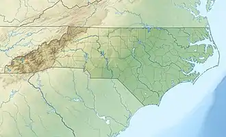 Location of Cross Creek mouth  Cross Creek (Cape Fear River tributary) (the United States) | |
| Location | |
| Country | United States |
| State | North Carolina |
| County | Cumberland |
| City | Fayetteville |
| Physical characteristics | |
| Source | Little Cross Creek divide |
| • location | pond in Fort Bragg on west side of Fayetteville, North Carolina |
| • coordinates | 35°07′52″N 078°56′33″W[1] |
| • elevation | 190 ft (58 m)[2] |
| Mouth | Cape Fear River |
• location | east side of Fayetteville, North Carolina |
• coordinates | 35°03′04″N 078°51′25″W[1] |
• elevation | 48 ft (15 m)[2] |
| Length | 9.70 mi (15.61 km)[3] |
| Basin size | 40.09 square miles (103.8 km2)[4] |
| Discharge | |
| • location | Cape Fear River |
| • average | 39.75 cu ft/s (1.126 m3/s) at mouth with Cape Fear River[4] |
| Basin features | |
| Progression | Cape Fear River → Atlantic Ocean |
| River system | Cape Fear River |
| Tributaries | |
| • left | unnamed tributaries |
| • right | Little Cross Creek Blounts Creek |
| Waterbodies | Rose Lake |
| Bridges | NC 295, Shaw Mill Road, Country Club Drive, Langdon Street, Murchison Road, Blue Street, US 401, NC 24, Bragg Boulevard, Hillsboro Street, Ray Avenue, Green Street, Ann Street, N Cool Spring Street, NC 210, I-95-US 301 |
Variant names
According to the Geographic Names Information System, it has also been known historically as:[1]
- Crosscreek
- Fayetteville
Course
Cross Creek rises on the west side of Fayetteville, North Carolina in Fort Bragg. Cross Creek then flows southeast through Fayetteville to join the Cape Fear River on the east side of Fayetteville.[2]
Watershed
Cross Creek drains 40.09 square miles (103.8 km2) of area, receives about 47.2 in/year of precipitation, has a wetness index of 489.33 and is about 20% forested.[4]
See also
References
- "GNIS Detail - Cross Creek". geonames.usgs.gov. US Geological Survey. Retrieved 7 September 2020.
- "Cross Creek Topo Map in Cumberland". TopoZone. Locality, LLC. Retrieved 7 September 2020.
- "ArcGIS Web Application". epa.maps.arcgis.com. US EPA. Retrieved 7 September 2020.
- "Cross Creek Watershed Report". US EPA Geoviewer. US EPA. Retrieved 7 September 2020.
This article is issued from Wikipedia. The text is licensed under Creative Commons - Attribution - Sharealike. Additional terms may apply for the media files.