Cul de Sac River
The Cul De Sac River is a river in Castries Quarter of the island country of Saint Lucia. It flows north and then west from the central highlands in the south of the island, reaching the Caribbean Sea in Grand Cul de Sac Bay, south of the capital, Castries. It is one of the longest rivers in Saint Lucia.[1][2][3]
| Cul de Sac River | |
|---|---|
 Cul de Sac Valley and the Hess Oil Terminal | |
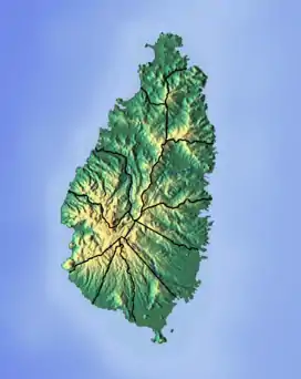 Location of mouth | |
| Location | |
| Country | Saint Lucia |
| Region | Castries Quarter |
| Physical characteristics | |
| Mouth | Grand Cul de Sac Bay |
• location | Castries |
• coordinates | 13°59′02″N 61°00′40″W |
See also
References
- "Cul de Sac River". National Geospatial Intelligence Agency. Retrieved August 3, 2021.
- "Integrating the Management of Watersheds and Coastal Areas in St. Lucia". Water Resources Management Unit, Ministry of Agriculture, Forestry and Fisheries Government of St. Lucia. 2001. Retrieved August 3, 2021.
- Breen, Henry H. (1844). St. Lucia: Historical, Statistical, and Descriptive. London: Longman, Brown, Green, and Longmans. p. 10.
- Higgins, Chris (2001). St. Lucia. Montreal: Ulysses Travel Guides. ISBN 2-89464-396-9.
This article is issued from Wikipedia. The text is licensed under Creative Commons - Attribution - Sharealike. Additional terms may apply for the media files.