Cunninghams Gap
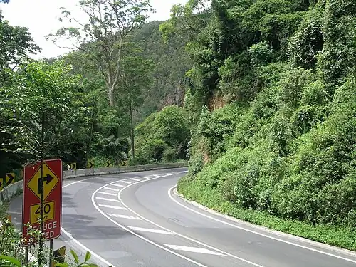
Cunninghams Gap is a pass over the Great Dividing Range between the Darling Downs and the Fassifern Valley in Queensland, Australia. The Gap is the major route over the Main Range along the Great Dividing Range, between Warwick and Brisbane. The Cunningham Highway was built to provide road transport between the two regions.
| Cunninghams Gap | |
|---|---|
| Cappoong[1] | |
 View from Kents Lagoon, 2015 | |
| Elevation | 787 metres |
| Traversed by | Allan Cunningham |
| Location | Tarome, South East Queensland, Queensland |
| Range | Main Range |

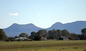
It is situated in Main Range National Park, between the peaks of Mount Cordeaux and Mount Mitchell. On a clear day the pass forms a distinct break in Main Range's profile as seen from Brisbane. It is located in Tregony in the Southern Downs Region immediately beside the boundary to Tarome in the Scenic Rim Region local government area.
The highway itself is a scenic drive although steep with an 8-degree grade on the descent.
History
The Indigenous name for the location is Cappoong, though the meaning is unknown.[1] The local Indigenous people have a legend about the creation of the gap. In the dreamtime, the Yuggera people rounded up all the kangaroos in the area and fenced them into the valley west of Minto Crags (Whinpullin) to prevent other tribes from catching them. However, an old woman set them free. As they stampeded across the Great Dividing Range they tore a gap between Mount Mitchell (Coonyin-nirra) and Mount Cordeaux (Niamboyoo).[2]
In 1827, Allan Cunningham set out from the upper Hunter River, to explore west of the Dividing Range, exploring the Darling Downs; returning in 1828 from Brisbane to explore Cunninghams Gap.[3] He was aware of the economic benefits that a link between the coast and pastoral lands to the west would provide.[4] Cunningham travelled on the right hand side of the Gap whereas the highway today runs on the lefthand side from Aratula.
On 3 July 1909, Cunninghams Gap was declared a national park.[5] This new park, which originally consisted of 3,100 acres, was located on the western side of the range and included Gap Creek.[6] Walking tracks were constructed in the 1930s and 1950s.[5]
On 11 June 1927, the 100-year anniversary of Allan Cunningham's exploration of the Darling Downs, the new road through Cunningham's Gap was officially opened by the local Member of Parliament, Sir Littleton Groom.[7] Although the road, which was built entirely by volunteers, was officially open, travelling along this new route was inadvisable, especially on the portion west of Aratula.[7] The road was plagued by problems during this early embryonic stage with the Royal Automobile Club of Queensland announcing that the road was closed, less than one month after it was officially opened.[8] The new sealed road through the gap was eventually opened in November 1949.[9]
Recent
Cunninghams Gap is part of the Cunningham Highway, a federally funded highway managed by the Queensland Department of Transport and Main Roads.[10] Between December 2010 and March 2011, the Gap experienced over two metres of rainfall and it sustained an enormous amount of damage.[10] The cost of repairing this seven kilometre stretch of road is projected to be $40 million.[10][11] Work is being undertaken by the Department of Transport and Main Roads in partnership with engineering firm Coffey.[11]
See also
References
- "Some Native Names", The Brisbane Courier, 3 June 1930, p.12
- Steele, John (1984). Aboriginal Pathways in Southeast Queensland and the Richmon,d River. University of Queensland Press. p. 146. ISBN 0-7022-1943-6.
- Perry, T.M. (1966). "Allan Cunningham". National Centre of Biography, Australian National University. Retrieved 15 September 2011.
- Queensland Environmental Protection Agency (2000). Heritage Trails of the Great South East. State of Queensland. p. 35. ISBN 0-7345-1008-X.
- "Main Range National Park: Nature, culture and history". Department of Environment and Resource Management. 1 April 2011. Archived from the original on 13 September 2011. Retrieved 15 September 2011.
- "National Park". The Brisbane Courier. Qld.: National Library of Australia. 2 July 1909. p. 6. Retrieved 16 September 2011.
- "Cunningham's Gap". The Brisbane Courier. Qld.: National Library of Australia. 13 June 1927. p. 13. Retrieved 12 August 2011.
- "Week-end Trips – State of Roads – Royal Automobile Club's Reports". The Brisbane Courier. Qld.: National Library of Australia. 2 July 1927. p. 18. Retrieved 14 August 2011.
- "Minister opens new highway". The Courier-Mail. Qld.: National Library of Australia. 7 November 1949. p. 3. Retrieved 13 September 2011.
- "Cunningham's Gap reconstruction, Cunningham Highway". Department of Transport and Main Roads. 29 July 2011. Archived from the original on 3 November 2011. Retrieved 16 September 2011.
- Dietrich, Georg (Managing Editor) (2011). "Flood-stricken highway on the road to recovery". Engineers Australia: Civil Edition. 84 (10): 39–40.
{{cite journal}}:|first1=has generic name (help)