Cwmifor
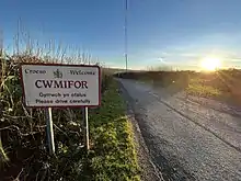
Cwmifor is a small village in Carmarthenshire.[1] It is a part of the Manordeilo and Salem community and is located between Llandeilo and Llandovery, near the A40.
The village consists of a number of dispersed farmhouses, most of which were built in the eighteenth and nineteenth centuries. In the twentieth century, a number of small houses were built near to the A40, transforming the village into a 'small nucleated settlement'.[2]

History
It is likely that the name Cwmifor derived from a person's name ('Cwm Ifor' means "Ifor's Valley"). An extensive Neolithic (4000–2200 BC) occupation site comprising numerous pits and post-holes, with finds of burnt bone, flints and charcoal, was recorded at Cwmifor.[3][4]
A Roman road known as the Via Julia ran east to west at the northern extremity of the settlement.[5] A turnpike road was established in the eighteenth century and followed the line of the Roman road although the course through Cwmifor was straightened under Thomas Telford in the 1820s.[6]
The village remained a dispersed settlement into the 1880s, with an Ordnance Survey map from 1886 showing a public house, a parish church, and a Baptist chapel. Several prominent farms and houses are also named on the map, many of which remain today (Cae Mawr, Pen-y-Waen, and Penhill).[7]
In 2002, Carmarthenshire Council earmarked the village primary school for closure. According to one report, the school had twenty three pupils at the time of the decision.[8] In 2007, it was reported on social media that the school had a total of seven pupils.[9]
Landmarks
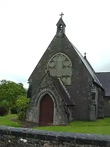
St Paul's Church is a nineteenth-century church in Cwmifor. While it was originally designed as a Roman Catholic church, it became an Anglican chapel of ease once it was completed. The church is built of squared stone.[10]
A Baptist chapel was built in 1789, enlarged in 1836 and renovated in 1864. It is built in the simple round-headed style with a long-wall entry plan.[11][12]

The village hall, or reading room, is next door to St Paul's Church. Manordeilo and Salem Community Council meet in the village hall each month.[13]
References
- "#GetOutside: do more in the British Outdoors". OS GetOutside. Retrieved 9 May 2021.
- "CWM-IFOR - MANORDEILO". Dyfed Archeological Trust. Archived from the original on 22 November 2016. Retrieved 25 June 2021.
- "Dyfed Aarchaeology" (PDF). Dyfed Archaeology. Archived (PDF) from the original on 25 June 2021. Retrieved 25 June 2021.
- "Neolithic Farming and Wild Plant Exploitation in Western Britain: Archaeobotanical and Crop Stable Isotope Evidence from Wales (c. 4000–2200 cal BC)" (PDF). Proceedings of the Prehistoric Society. 85: 193–222. 2019.
- "View map: Carmarthenshire XXXIV.NW (includes: Llandeilo Fawr Rural; Llangadog.) - Ordnance Survey Six-inch England and Wales, 1842-1952". maps.nls.uk. Retrieved 20 December 2021.
- "Ystrad Tywi". Dyfed Archaeological Trust. Archived from the original on 25 June 2021. Retrieved 25 June 2021.
- "View map: Carmarthenshire XXXIV.NW (includes: Llandeilo Fawr Rural; Llangadog.) - Ordnance Survey Six-inch England and Wales, 1842-1952". maps.nls.uk. Retrieved 20 December 2021.
- "Parents fight school closure plans". BBC News. 12 September 2002. Archived from the original on 1 November 2002. Retrieved 25 June 2021.
- "Twitter". Archived from the original on 8 July 2021. Retrieved 25 June 2021.
- "St Paul's Church, Cwm-ifor, Manordeilo (421081)". Coflein. RCAHMW. Retrieved 25 June 2021.
- "Cwmifor Welsh Baptist Church (6354)". Coflein. RCAHMW. Retrieved 25 June 2021.
- "See Around Britain". Archived from the original on 25 June 2021. Retrieved 25 June 2021.
- "Manordeilo and Salem Community Council: Home". manordeilosalemcc.org.uk. Retrieved 23 May 2022.