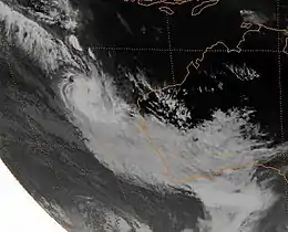
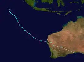
1987–88 Australian region cyclone season
The 1987–88 Australian region cyclone season was the one of least active Australian region tropical cyclone seasons on record. It officially started on 1 November 1987, and officially ended on 30 April 1988. The regional tropical cyclone operational plan defines a "tropical cyclone year" separately from a "tropical cyclone season"; the "tropical cyclone year" began on 1 July 1987 and ended on 30 June 1988.[1]
| 1987–88 Australian region cyclone season | |
|---|---|
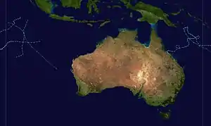 Season summary map | |
| Seasonal boundaries | |
| First system formed | 6 December 1987 |
| Last system dissipated | 20 May 1988 |
| Strongest storm | |
| Name | Gwenda-Ezenina |
| • Maximum winds | 185 km/h (115 mph) (10-minute sustained) |
| • Lowest pressure | 940 hPa (mbar) |
| Seasonal statistics | |
| Tropical lows | 6 (record low) |
| Tropical cyclones | 5 |
| Severe tropical cyclones | 3 |
| Total fatalities | 1 |
| Total damage | $17.9 million (1988 USD) |
| Related articles | |
Seasonal summary

Systems
Tropical Low Ariny
| Tropical low (Australian scale) | |
  | |
| Duration | 6 December – 9 December (Exited basin) |
|---|---|
| Peak intensity | 55 km/h (35 mph) (10-min); |
Tropical Cyclone Agi
| Category 2 tropical cyclone (Australian scale) | |
| Category 1 tropical cyclone (SSHWS) | |
  | |
| Duration | 6 January (Entered basin) – 14 January (Exited basin) |
|---|---|
| Peak intensity | 95 km/h (60 mph) (10-min); 980 hPa (mbar) |
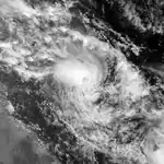
Cyclone Agi veered away from the main islands of Papua New Guinea's Milne Bay province after flattening many buildings, uprooting trees and disrupting water supplies. Agi brought heavy rain, high tides and winds gusting at more than 100 km/h to the remote islands it brushed at the eastern tip of the PNG mainland since it formed and began to swirl through the area on Sunday.
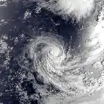
Severe Tropical Cyclone Frederic
| Category 3 severe tropical cyclone (Australian scale) | |
| Category 1 tropical cyclone (SSHWS) | |
  | |
| Duration | 28 January – 2 February |
|---|---|
| Peak intensity | 150 km/h (90 mph) (10-min); 955 hPa (mbar) |
Frederic, 28 January to 2 February 1988, Indian Ocean
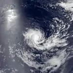
Severe Tropical Cyclone Gwenda-Ezenina
| Category 4 severe tropical cyclone (Australian scale) | |
| Category 2 tropical cyclone (SSHWS) | |
  | |
| Duration | 6 February – 12 February (Exited basin) |
|---|---|
| Peak intensity | 185 km/h (115 mph) (10-min); 941 hPa (mbar) |
Gwenda-Ezenina, 6 to 12 February 1988, Indian Ocean
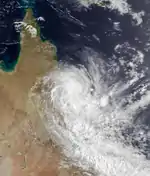
Severe Tropical Cyclone Charlie
| Category 3 severe tropical cyclone (Australian scale) | |
| Category 1 tropical cyclone (SSHWS) | |
  | |
| Duration | 19 February – 1 March |
|---|---|
| Peak intensity | 150 km/h (90 mph) (10-min); 972 hPa (mbar) |
Early on 21 February, a tropical low formed over the Coral Sea. The system was upgraded to a tropical cyclone at 18:00 UTC on 22 February, given the name Charlie. Charlie continued to strengthen for around a day while turning towards the south, however began to weaken soon after. Following a period of slight weakening, Charlie maintained its intensity and slowly moved towards the west. Early on 27 February, Charlie began to intensify once again, continuing its westerly movement until 36 hours later, when it turned towards the south. Charlie made its first landfall near Cape Bowling Green and reached its peak intensity as a Category 3 severe tropical cyclone during 29 February and later made its second landfall, in Upstart Bay. The cyclone weakened rapidly over land and dissipated on 1 March.[2]
As Charlie made landfall in a sparsely populated area, structural damage was minimal, however significant crop damage occurred, amounting to $15 million (1990 AUD).[3]
See also
References
- "Tropical Cyclone Operational plan for the South Pacific & Southeast Indian Ocean 2008" (PDF). WMO. Archived from the original (PDF) on 2012-07-28. Retrieved 2008-12-11.
- "Tropical Cyclone Charlie". BOM. Archived from the original on 2022-02-07. Retrieved 2022-03-30.
- "Cyclone Charlie". HardenUp. Archived from the original on 2022-03-30. Retrieved 2022-03-30.
