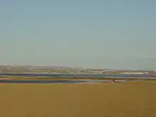
Darnley Bay
Darnley Bay is a large inlet in the Northwest Territories, Canada. It is a southern arm of the Amundsen Gulf. The bay measures 45 km (28 mi) long, and 32 km (20 mi) wide at its mouth.[1]

The Parry Peninsula is to the west and Halcro Point is to the east. The Canadian Shield originates east of Darnley Bay, the terrain sloping upwards, and characterized by glacial deposits.[2]
The bay was named by John Richardson, while travelling with John Franklin during the Second Overland Expedition, for John Bligh, 4th Earl of Darnley.[3]
In 1915, the Canadian Arctic Expedition of 1913-16 was the first to delineate the southern shore of Darnley Bay.[4] The Hornaday River drains into the bay's southern shores, 14 km (8.7 mi) east of the Inuvialuit hamlet of Paulatuk.[5]
References
- "Darnley Bay". The Columbia Gazetteer of North America. bartleby.com. 2000. Archived from the original on 2005-01-29. Retrieved 2009-03-07.
- "The Northwest Territories". uoguelph.ca. Archived from the original on 2016-03-04. Retrieved 2009-03-07.
- Gazetteer of the Northwest Territories (PDF) (Report). July 2013. Archived from the original on September 27, 2013.
- Davis, Richard Clarke (1996). Lobsticks and Stone Cairns: Human Landmarks in the Arctic. University of Calgary Press. pp. 153–154. ISBN 1-895176-88-3.
riviere la ronciere-le noury Hornaday.
- "Tuktut Nogait National Park of Canada: Activities: Paddling". pc.gc.ca. Archived from the original on 2004-03-14. Retrieved 2009-03-06.