De Hoef, Utrecht
De Hoef is a village in the Dutch province of Utrecht. It is a part of the municipality of De Ronde Venen, and lies about 13 km northeast of Alphen aan den Rijn.
De Hoef | |
|---|---|
Village | |
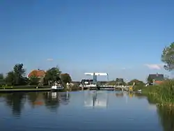 Bridge across the Kromme Mijdrecht | |
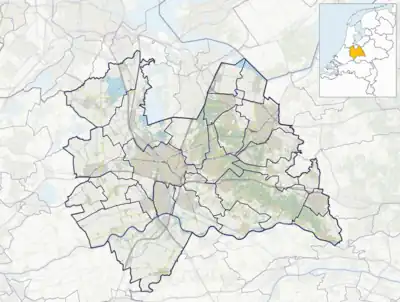 De Hoef Location in the Netherlands  De Hoef De Hoef (Netherlands) | |
| Coordinates: 52°12′35″N 4°48′53″E | |
| Country | Netherlands |
| Province | Utrecht |
| Municipality | De Ronde Venen |
| Area | |
| • Total | 5.68 km2 (2.19 sq mi) |
| Elevation | −1.1 m (−3.6 ft) |
| Population (2021)[1] | |
| • Total | 880 |
| • Density | 150/km2 (400/sq mi) |
| Time zone | UTC+1 (CET) |
| • Summer (DST) | UTC+2 (CEST) |
| Postal code | 1426[1] |
| Dialing code | 0297 |
Flowing through the village is a meandering river called "de Kromme Mijdrecht", the width of which varies between about 8 and 35 metres. On average, it is used by about two freight ships per day, but in summer the river is full of pleasure boats.
It was first mentioned in 1639 as De Hoeff, and means "parcel of land".[3] In 1840, it was home to 266 people. In 1921, the Roman Catholic Antonius van Padua Church was built.[4]
Gallery
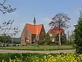 Church of De Hoef
.jpg.webp) River view
River view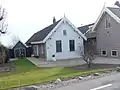 House in De Hoef
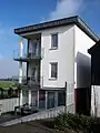 House in De Hoef
Notable residents
- Nicolien Sauerbreij (born 1979), Olympic champion snowboard (born in De Hoef)
References
- "Kerncijfers wijken en buurten 2021". Central Bureau of Statistics. Retrieved 28 March 2022.
- "Postcodetool for 1426AA". Actueel Hoogtebestand Nederland (in Dutch). Het Waterschapshuis. Retrieved 28 March 2022.
- "De Hoef - (geografische naam)". Etymologiebank (in Dutch). Retrieved 28 March 2022.
- "De Hoef". Plaatsengids (in Dutch). Retrieved 28 March 2022.
Wikimedia Commons has media related to De Hoef (Utrecht).
This article is issued from Wikipedia. The text is licensed under Creative Commons - Attribution - Sharealike. Additional terms may apply for the media files.