Deir Asfin
Deir ʿAsfīn (Arabic: دير عسفين, "Convent of Deviation")[1] was a former monastery in Ottoman Palestine located just north of Tira in present-day Israel. It appeared on Sheet XI of the 19th-century Survey of Western Palestine[1] and its peak formed the highest point of the Falik Hills in the maritime plains south of Mount Carmel, with an elevation of 92 meters (302 ft) above sea level.[2] It has also been identified as the location of the Theraspis (Greek: Θερασπις) that appears on the Madaba Map of 6th-century Byzantine Palestine.[3]
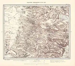
Sheet XI of the Survey of Western Palestine, showing Deir ʿAsfīn in the lower left
References
Citations
- Palmer (1881), p. 181
- Saunders (1881), p. 133.
- Casanowicz (1915), p. 368.
Bibliography
- Casanowicz, I.W. (1915), "A Colored Drawing of the Medeba Map of Palestine in the United States National Museum" (PDF), Proceedings of the US National Museum, Washington: Smithsonian Institution Press, vol. 49, no. 2111, pp. 359–376.
- Palmer, E.H. (1881), Arabic and English Name Lists, The Survey of Western Palestine, London: Palestine Exploration Fund.
- Saunders, Trelawney (1881), An Introduction to the Survey of Western Palestine: Its Waterways, Plains, & Highlands (PDF), London: Palestine Exploration Fund.
This article is issued from Wikipedia. The text is licensed under Creative Commons - Attribution - Sharealike. Additional terms may apply for the media files.